Distance from Daund to Shrigonda
Distance between Daund and Shrigonda is 21 kilometers (13 miles).
Driving distance from Daund to Shrigonda is 26 kilometers (16 miles).
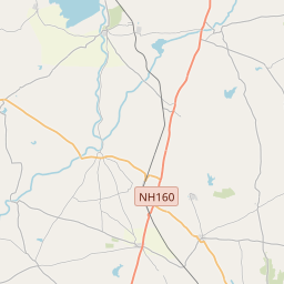
Distance Map Between Daund and Shrigonda
Daund, Mumbai, India ↔ Shrigonda, Mumbai, India = 13 miles = 21 km.


How far is it between Daund and Shrīgonda
Daund is located in India with (18.4652,74.5838) coordinates and Shrigonda is located in India with (18.6153,74.699) coordinates. The calculated flying distance from Daund to Shrigonda is equal to 13 miles which is equal to 21 km.
If you want to go by car, the driving distance between Daund and Shrigonda is 26.3 km. If you ride your car with an average speed of 112 kilometers/hour (70 miles/h), travel time will be 00 hours 14 minutes. Please check the avg. speed travel time table on the right for various options.
Difference between fly and go by a car is 5 km.
| City/Place | Latitude and Longitude | GPS Coordinates |
|---|---|---|
| Daund | 18.4652, 74.5838 | 18° 27´ 54.5400'' N 74° 35´ 1.5000'' E |
| Shrigonda | 18.6153, 74.699 | 18° 36´ 54.9720'' N 74° 41´ 56.2200'' E |
Estimated Travel Time Between Daund and Shrīgonda
| Average Speed | Travel Time |
|---|---|
| 30 mph (48 km/h) | 00 hours 32 minutes |
| 40 mph (64 km/h) | 00 hours 24 minutes |
| 50 mph (80 km/h) | 00 hours 19 minutes |
| 60 mph (97 km/h) | 00 hours 16 minutes |
| 70 mph (112 km/h) | 00 hours 14 minutes |
| 75 mph (120 km/h) | 00 hours 13 minutes |
Related Distances from Daund
| Cities | Distance |
|---|---|
| Daund to Pune | 82 km |
| Daund to Indapur | 195 km |
| Daund to Solapur | 186 km |
| Daund to Tuljapur | 227 km |
| Daund to Shrigonda | 26 km |
Related Distances to Shrigonda
| Cities | Distance |
|---|---|
| Pune to Shrigonda | 105 km |
| Sangamner to Shrigonda | 156 km |
| Aurangabad to Shrigonda | 176 km |
| Baramati to Shrigonda | 69 km |
| Satara to Shrigonda | 149 km |