Distance from Davie to Alvaro Obregon
Distance between Davie and Alvaro Obregon is 2081 kilometers (1293 miles).
Driving distance from Davie to Alvaro Obregon is 3481 kilometers (2163 miles).
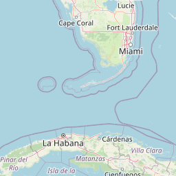
Distance Map Between Davie and Alvaro Obregon
Davie, Tallahassee, United States ↔ Alvaro Obregon, Mexico City, Mexico = 1293 miles = 2081 km.


How far is it between Davie and Álvaro Obregón
Davie is located in United States with (26.0629,-80.2331) coordinates and Alvaro Obregon is located in Mexico with (19.3587,-99.2033) coordinates. The calculated flying distance from Davie to Alvaro Obregon is equal to 1293 miles which is equal to 2081 km.
If you want to go by car, the driving distance between Davie and Alvaro Obregon is 3481 km. If you ride your car with an average speed of 112 kilometers/hour (70 miles/h), travel time will be 31 hours 04 minutes. Please check the avg. speed travel time table on the right for various options.
Difference between fly and go by a car is 1400 km.
| City/Place | Latitude and Longitude | GPS Coordinates |
|---|---|---|
| Davie | 26.0629, -80.2331 | 26° 3´ 46.3320'' N 80° 13´ 59.1600'' W |
| Alvaro Obregon | 19.3587, -99.2033 | 19° 21´ 31.2120'' N 99° 12´ 11.8440'' W |
Estimated Travel Time Between Davie and Álvaro Obregón
| Average Speed | Travel Time |
|---|---|
| 30 mph (48 km/h) | 72 hours 31 minutes |
| 40 mph (64 km/h) | 54 hours 23 minutes |
| 50 mph (80 km/h) | 43 hours 30 minutes |
| 60 mph (97 km/h) | 35 hours 53 minutes |
| 70 mph (112 km/h) | 31 hours 04 minutes |
| 75 mph (120 km/h) | 29 hours 00 minutes |
Related Distances from Davie
| Cities | Distance |
|---|---|
| Davie to Ecatepec | 3461 km |
| Davie to Mexico City | 3479 km |
| Davie to Merida | 4419 km |
| Davie to Alvaro Obregon | 3481 km |
| Davie to Naucalpan De Juarez | 3466 km |
Related Distances to Alvaro Obregon
| Cities | Distance |
|---|---|
| Phoenix to Alvaro Obregon | 2358 km |
| Channelview to Alvaro Obregon | 1631 km |
| Austin to Alvaro Obregon | 1505 km |
| Atlanta to Alvaro Obregon | 2879 km |
| Weslaco to Alvaro Obregon | 1084 km |