Distance from Delaware to Saltillo
Distance between Delaware and Saltillo is 2345 kilometers (1457 miles).
Driving distance from Delaware to Saltillo is 2708 kilometers (1683 miles).
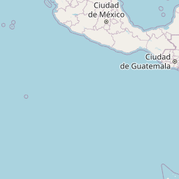
Distance Map Between Delaware and Saltillo
Delaware, Columbus, United States ↔ Saltillo, Mexico = 1457 miles = 2345 km.


How far is it between Delaware and Saltillo
Delaware is located in United States with (40.2987,-83.068) coordinates and Saltillo is located in Mexico with (25.4232,-101.0053) coordinates. The calculated flying distance from Delaware to Saltillo is equal to 1457 miles which is equal to 2345 km.
If you want to go by car, the driving distance between Delaware and Saltillo is 2708.35 km. If you ride your car with an average speed of 112 kilometers/hour (70 miles/h), travel time will be 24 hours 10 minutes. Please check the avg. speed travel time table on the right for various options.
Difference between fly and go by a car is 363 km.
| City/Place | Latitude and Longitude | GPS Coordinates |
|---|---|---|
| Delaware | 40.2987, -83.068 | 40° 17´ 55.2120'' N 83° 4´ 4.6920'' W |
| Saltillo | 25.4232, -101.0053 | 25° 25´ 23.5560'' N 101° 0´ 19.0800'' W |
Estimated Travel Time Between Delaware and Saltillo
| Average Speed | Travel Time |
|---|---|
| 30 mph (48 km/h) | 56 hours 25 minutes |
| 40 mph (64 km/h) | 42 hours 19 minutes |
| 50 mph (80 km/h) | 33 hours 51 minutes |
| 60 mph (97 km/h) | 27 hours 55 minutes |
| 70 mph (112 km/h) | 24 hours 10 minutes |
| 75 mph (120 km/h) | 22 hours 34 minutes |
Related Distances from Delaware
| Cities | Distance |
|---|---|
| Delaware to Monterrey | 2633 km |
| Delaware to Saltillo | 2708 km |
| Delaware to Guadalupe | 2641 km |
| Delaware to Nuevo Laredo | 2411 km |
| Delaware to San Nicolas De Los Garza | 2627 km |
Related Distances to Saltillo
| Cities | Distance |
|---|---|
| San Antonio to Saltillo | 557 km |
| Memphis to Saltillo | 1725 km |
| Durango 2 to Saltillo | 1896 km |
| Houston to Saltillo | 869 km |
| Las Vegas to Saltillo | 2132 km |