Distance from Dengzhou to Xiazhen
Distance between Dengzhou and Xiazhen is 467 kilometers (290 miles).
Driving distance from Dengzhou to Xiazhen is 604 kilometers (375 miles).
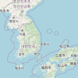
Distance Map Between Dengzhou and Xiazhen
Dengzhou, Jinan, China ↔ Xiazhen, Jinan, China = 290 miles = 467 km.


How far is it between Dengzhou and Xiazhen
Dengzhou is located in China with (37.8082,120.7591) coordinates and Xiazhen is located in China with (34.8022,117.1117) coordinates. The calculated flying distance from Dengzhou to Xiazhen is equal to 290 miles which is equal to 467 km.
If you want to go by car, the driving distance between Dengzhou and Xiazhen is 603.68 km. If you ride your car with an average speed of 112 kilometers/hour (70 miles/h), travel time will be 05 hours 23 minutes. Please check the avg. speed travel time table on the right for various options.
Difference between fly and go by a car is 137 km.
| City/Place | Latitude and Longitude | GPS Coordinates |
|---|---|---|
| Dengzhou | 37.8082, 120.7591 | 37° 48´ 29.5920'' N 120° 45´ 32.6880'' E |
| Xiazhen | 34.8022, 117.1117 | 34° 48´ 7.9920'' N 117° 6´ 42.0120'' E |
Estimated Travel Time Between Dengzhou and Xiazhen
| Average Speed | Travel Time |
|---|---|
| 30 mph (48 km/h) | 12 hours 34 minutes |
| 40 mph (64 km/h) | 09 hours 25 minutes |
| 50 mph (80 km/h) | 07 hours 32 minutes |
| 60 mph (97 km/h) | 06 hours 13 minutes |
| 70 mph (112 km/h) | 05 hours 23 minutes |
| 75 mph (120 km/h) | 05 hours 01 minutes |
Related Distances from Dengzhou
| Cities | Distance |
|---|---|
| Dengzhou to Yanzhou | 583 km |
| Dengzhou to Zibo | 318 km |
| Dengzhou to Pingdu | 185 km |
| Dengzhou to Tai An | 459 km |
| Dengzhou to Qufu | 561 km |
Related Distances to Xiazhen
| Cities | Distance |
|---|---|
| Nanma to Xiazhen | 288 km |
| Qingdao to Xiazhen | 451 km |
| Binzhou to Xiazhen | 386 km |
| Boshan to Xiazhen | 285 km |
| Pingyin to Xiazhen | 243 km |