Distance from DeSoto to Cleburne
Distance between DeSoto and Cleburne is 57 kilometers (35 miles).
Driving distance from DeSoto to Cleburne is 65 kilometers (40 miles).
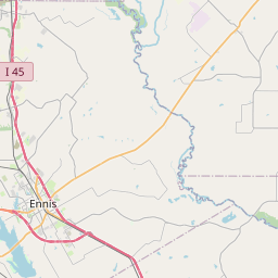
Distance Map Between DeSoto and Cleburne
DeSoto, Austin, United States ↔ Cleburne, Austin, United States = 35 miles = 57 km.


How far is it between DeSoto and Cleburne
DeSoto is located in United States with (32.5899,-96.857) coordinates and Cleburne is located in United States with (32.3476,-97.3867) coordinates. The calculated flying distance from DeSoto to Cleburne is equal to 35 miles which is equal to 57 km.
If you want to go by car, the driving distance between DeSoto and Cleburne is 64.7 km. If you ride your car with an average speed of 112 kilometers/hour (70 miles/h), travel time will be 00 hours 34 minutes. Please check the avg. speed travel time table on the right for various options.
Difference between fly and go by a car is 8 km.
| City/Place | Latitude and Longitude | GPS Coordinates |
|---|---|---|
| DeSoto | 32.5899, -96.857 | 32° 35´ 23.4960'' N 96° 51´ 25.0200'' W |
| Cleburne | 32.3476, -97.3867 | 32° 20´ 51.5040'' N 97° 23´ 12.0480'' W |
Estimated Travel Time Between DeSoto and Cleburne
| Average Speed | Travel Time |
|---|---|
| 30 mph (48 km/h) | 01 hours 20 minutes |
| 40 mph (64 km/h) | 01 hours 00 minutes |
| 50 mph (80 km/h) | 00 hours 48 minutes |
| 60 mph (97 km/h) | 00 hours 40 minutes |
| 70 mph (112 km/h) | 00 hours 34 minutes |
| 75 mph (120 km/h) | 00 hours 32 minutes |
Related Distances from DeSoto
| Cities | Distance |
|---|---|
| Desoto to Dallas | 27 km |
| Desoto to Arlington | 36 km |
| Desoto to Corsicana | 85 km |
| Desoto to Cedar Hill | 10 km |
| Desoto to Carrollton | 49 km |
Related Distances to Cleburne
| Cities | Distance |
|---|---|
| Dallas to Cleburne | 81 km |
| Fort Worth to Cleburne | 49 km |
| Waxahachie to Cleburne | 60 km |
| Mansfield 2 to Cleburne | 39 km |
| Waco to Cleburne | 101 km |