Distance from Didwana to Kota
Distance between Didwana and Kota is 277 kilometers (172 miles).
Driving distance from Didwana to Kota is 343 kilometers (213 miles).
Distance Map Between Didwana and Kota
Didwana, Jaipur, India ↔ Kota, Jaipur, India = 172 miles = 277 km.


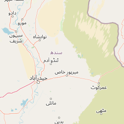


How far is it between Dīdwāna and Kota
Didwana is located in India with (27.401,74.5754) coordinates and Kota is located in India with (25.1825,75.8391) coordinates. The calculated flying distance from Didwana to Kota is equal to 172 miles which is equal to 277 km.
If you want to go by car, the driving distance between Didwana and Kota is 342.97 km. If you ride your car with an average speed of 112 kilometers/hour (70 miles/h), travel time will be 03 hours 03 minutes. Please check the avg. speed travel time table on the right for various options.
Difference between fly and go by a car is 66 km.
| City/Place | Latitude and Longitude | GPS Coordinates |
|---|---|---|
| Didwana | 27.401, 74.5754 | 27° 24´ 3.4560'' N 74° 34´ 31.3320'' E |
| Kota | 25.1825, 75.8391 | 25° 10´ 57.1440'' N 75° 50´ 20.6520'' E |
Estimated Travel Time Between Dīdwāna and Kota
| Average Speed | Travel Time |
|---|---|
| 30 mph (48 km/h) | 07 hours 08 minutes |
| 40 mph (64 km/h) | 05 hours 21 minutes |
| 50 mph (80 km/h) | 04 hours 17 minutes |
| 60 mph (97 km/h) | 03 hours 32 minutes |
| 70 mph (112 km/h) | 03 hours 03 minutes |
| 75 mph (120 km/h) | 02 hours 51 minutes |
Related Distances from Didwana
| Cities | Distance |
|---|---|
| Didwana to Kuchaman | 42 km |
| Didwana to Losal | 39 km |
| Didwana to Nagaur | 97 km |
| Didwana to Nawa | 70 km |
| Didwana to Ladnun | 35 km |
Related Distances to Kota
| Cities | Distance |
|---|---|
| Anta to Kota | 52 km |
| Kekri to Kota | 129 km |
| Keshorai Patan to Kota | 22 km |
| Begun to Kota | 120 km |
| Kapren to Kota | 41 km |