Distance from Diest to Stekene
Distance between Diest and Stekene is 75 kilometers (47 miles).
Driving distance from Diest to Stekene is 95 kilometers (59 miles).
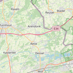
Distance Map Between Diest and Stekene
Diest, , Belgium ↔ Stekene, , Belgium = 47 miles = 75 km.


How far is it between Diest and Stekene
Diest is located in Belgium with (50.9892,5.0506) coordinates and Stekene is located in Belgium with (51.2099,4.0365) coordinates. The calculated flying distance from Diest to Stekene is equal to 47 miles which is equal to 75 km.
If you want to go by car, the driving distance between Diest and Stekene is 95.03 km. If you ride your car with an average speed of 112 kilometers/hour (70 miles/h), travel time will be 00 hours 50 minutes. Please check the avg. speed travel time table on the right for various options.
Difference between fly and go by a car is 20 km.
| City/Place | Latitude and Longitude | GPS Coordinates |
|---|---|---|
| Diest | 50.9892, 5.0506 | 50° 59´ 21.2280'' N 5° 3´ 2.2320'' E |
| Stekene | 51.2099, 4.0365 | 51° 12´ 35.6400'' N 4° 2´ 11.4360'' E |
Estimated Travel Time Between Diest and Stekene
| Average Speed | Travel Time |
|---|---|
| 30 mph (48 km/h) | 01 hours 58 minutes |
| 40 mph (64 km/h) | 01 hours 29 minutes |
| 50 mph (80 km/h) | 01 hours 11 minutes |
| 60 mph (97 km/h) | 00 hours 58 minutes |
| 70 mph (112 km/h) | 00 hours 50 minutes |
| 75 mph (120 km/h) | 00 hours 47 minutes |
Related Distances from Diest
| Cities | Distance |
|---|---|
| Diest to Hasselt | 28 km |
| Diest to Leuven | 34 km |
| Diest to Halle | 90 km |
| Diest to Kontich | 82 km |
| Diest to Tienen | 23 km |
Related Distances to Stekene
| Cities | Distance |
|---|---|
| Gent to Stekene | 43 km |
| Izegem to Stekene | 88 km |
| Maaseik to Stekene | 144 km |
| Oudenaarde to Stekene | 63 km |
| Ronse to Stekene | 75 km |