Distance from Dir to Delhi
Distance between Dir and Delhi is 886 kilometers (551 miles).
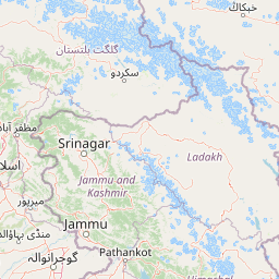
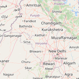
Distance Map Between Dir and Delhi
Dir, Peshawar, Pakistan ↔ Delhi, New Delhi, India = 551 miles = 886 km.


Leaflet | © OpenStreetMap
How far is it between Dīr and Delhi
Dir is located in Pakistan with (35.2058,71.8756) coordinates and Delhi is located in India with (28.6538,77.229) coordinates. The calculated flying distance from Dir to Delhi is equal to 551 miles which is equal to 886 km.
| City/Place | Latitude and Longitude | GPS Coordinates |
|---|---|---|
| Dir | 35.2058, 71.8756 | 35° 12´ 20.9880'' N 71° 52´ 32.0160'' E |
| Delhi | 28.6538, 77.229 | 28° 39´ 13.7160'' N 77° 13´ 44.2920'' E |
Dir, Peshawar, Pakistan
Related Distances from Dir
| Cities | Distance |
|---|---|
| Dir to Mardan | 180 km |
| Dir to Mingora | 151 km |
| Dir to Swabi | 239 km |
| Dir to Mansehra | 361 km |
| Dir to Kohat | 303 km |
Delhi, New Delhi, India
Related Distances to Delhi
| Cities | Distance |
|---|---|
| Lahore to Delhi | 5044 km |
| Islamabad to Delhi | 5812 km |
| Karachi to Delhi | 6101 km |
| Bahawalpur to Delhi | 5316 km |
| Khanpur 2 to Delhi | 6397 km |