Distance from Dixiana to Daphne
Distance between Dixiana and Daphne is 368 kilometers (229 miles).
Driving distance from Dixiana to Daphne is 446 kilometers (277 miles).
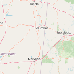
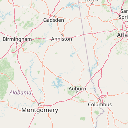
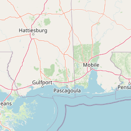
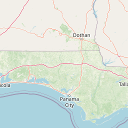
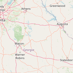
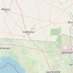
Distance Map Between Dixiana and Daphne
Dixiana, Montgomery, United States ↔ Daphne, Montgomery, United States = 229 miles = 368 km.


How far is it between Dixiana and Daphne
Dixiana is located in United States with (33.7402,-86.6494) coordinates and Daphne is located in United States with (30.6035,-87.9036) coordinates. The calculated flying distance from Dixiana to Daphne is equal to 229 miles which is equal to 368 km.
If you want to go by car, the driving distance between Dixiana and Daphne is 445.74 km. If you ride your car with an average speed of 112 kilometers/hour (70 miles/h), travel time will be 03 hours 58 minutes. Please check the avg. speed travel time table on the right for various options.
Difference between fly and go by a car is 78 km.
| City/Place | Latitude and Longitude | GPS Coordinates |
|---|---|---|
| Dixiana | 33.7402, -86.6494 | 33° 44´ 24.7560'' N 86° 38´ 57.7680'' W |
| Daphne | 30.6035, -87.9036 | 30° 36´ 12.7080'' N 87° 54´ 12.9600'' W |
Estimated Travel Time Between Dixiana and Daphne
| Average Speed | Travel Time |
|---|---|
| 30 mph (48 km/h) | 09 hours 17 minutes |
| 40 mph (64 km/h) | 06 hours 57 minutes |
| 50 mph (80 km/h) | 05 hours 34 minutes |
| 60 mph (97 km/h) | 04 hours 35 minutes |
| 70 mph (112 km/h) | 03 hours 58 minutes |
| 75 mph (120 km/h) | 03 hours 42 minutes |
Related Distances from Dixiana
| Cities | Distance |
|---|---|
| Dixiana to Decatur 2 | 128 km |
| Dixiana to Phenix City | 259 km |
| Dixiana to Hueytown | 53 km |
| Dixiana to Helena 2 | 67 km |
| Dixiana to Homewood | 37 km |
Related Distances to Daphne
| Cities | Distance |
|---|---|
| Fairhope to Daphne | 9 km |
| Mobile to Daphne | 21 km |
| Auburn 2 to Daphne | 354 km |
| Hoover to Daphne | 397 km |
| Tuscaloosa to Daphne | 335 km |