Distance from Djelfa to Saida
Distance between Djelfa and Saida is 285 kilometers (177 miles).
Driving distance from Djelfa to Saida is 408 kilometers (253 miles).
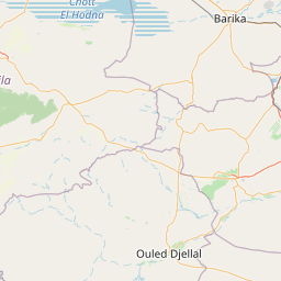
Distance Map Between Djelfa and Saida
Djelfa, Algeria ↔ Saida, Algeria = 177 miles = 285 km.


How far is it between Djelfa and Saïda
Djelfa is located in Algeria with (34.6728,3.263) coordinates and Saida is located in Algeria with (34.8303,0.1517) coordinates. The calculated flying distance from Djelfa to Saida is equal to 177 miles which is equal to 285 km.
If you want to go by car, the driving distance between Djelfa and Saida is 407.87 km. If you ride your car with an average speed of 112 kilometers/hour (70 miles/h), travel time will be 03 hours 38 minutes. Please check the avg. speed travel time table on the right for various options.
Difference between fly and go by a car is 123 km.
| City/Place | Latitude and Longitude | GPS Coordinates |
|---|---|---|
| Djelfa | 34.6728, 3.263 | 34° 40´ 22.0440'' N 3° 15´ 46.8000'' E |
| Saida | 34.8303, 0.1517 | 34° 49´ 49.1880'' N 0° 9´ 6.1560'' E |
Estimated Travel Time Between Djelfa and Saïda
| Average Speed | Travel Time |
|---|---|
| 30 mph (48 km/h) | 08 hours 29 minutes |
| 40 mph (64 km/h) | 06 hours 22 minutes |
| 50 mph (80 km/h) | 05 hours 05 minutes |
| 60 mph (97 km/h) | 04 hours 12 minutes |
| 70 mph (112 km/h) | 03 hours 38 minutes |
| 75 mph (120 km/h) | 03 hours 23 minutes |
Related Distances from Djelfa
| Cities | Distance |
|---|---|
| Djelfa to Medea | 220 km |
| Djelfa to Tissemsilt | 218 km |
| Djelfa to Sidi Bel Abbes | 510 km |
| Djelfa to Mila | 425 km |
| Djelfa to El Bayadh | 305 km |
Related Distances to Saida
| Cities | Distance |
|---|---|
| Oran to Saida | 163 km |
| Ain Sefra to Saida | 259 km |
| Algiers to Saida | 436 km |
| El Bayadh to Saida | 194 km |
| Ain Temouchent to Saida | 156 km |