Distance from Dolores to Zarate
Distance between Dolores and Zarate is 275 kilometers (171 miles).
Driving distance from Dolores to Zarate is 307 kilometers (190 miles).
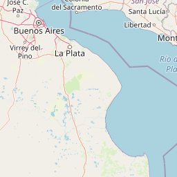
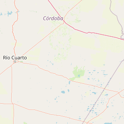
Distance Map Between Dolores and Zarate
Dolores, La Plata, Argentina ↔ Zarate, La Plata, Argentina = 171 miles = 275 km.


How far is it between Dolores and Zárate
Dolores is located in Argentina with (-36.3132,-57.6792) coordinates and Zarate is located in Argentina with (-34.0981,-59.0286) coordinates. The calculated flying distance from Dolores to Zarate is equal to 171 miles which is equal to 275 km.
If you want to go by car, the driving distance between Dolores and Zarate is 306.52 km. If you ride your car with an average speed of 112 kilometers/hour (70 miles/h), travel time will be 02 hours 44 minutes. Please check the avg. speed travel time table on the right for various options.
Difference between fly and go by a car is 32 km.
| City/Place | Latitude and Longitude | GPS Coordinates |
|---|---|---|
| Dolores | -36.3132, -57.6792 | 36° 18´ 47.5560'' S 57° 40´ 45.0480'' W |
| Zarate | -34.0981, -59.0286 | 34° 5´ 53.3040'' S 59° 1´ 42.8880'' W |
Estimated Travel Time Between Dolores and Zárate
| Average Speed | Travel Time |
|---|---|
| 30 mph (48 km/h) | 06 hours 23 minutes |
| 40 mph (64 km/h) | 04 hours 47 minutes |
| 50 mph (80 km/h) | 03 hours 49 minutes |
| 60 mph (97 km/h) | 03 hours 09 minutes |
| 70 mph (112 km/h) | 02 hours 44 minutes |
| 75 mph (120 km/h) | 02 hours 33 minutes |
Related Distances from Dolores
| Cities | Distance |
|---|---|
| Dolores to Mar Del Plata | 200 km |
| Dolores to Mercedes | 266 km |
| Dolores to San Isidro 2 | 238 km |
| Dolores to Lujan | 287 km |
| Dolores to Necochea | 298 km |
Related Distances to Zarate
| Cities | Distance |
|---|---|
| Campana to Zarate | 11 km |
| Bahia Blanca to Zarate | 692 km |
| Azul to Zarate | 359 km |
| Tigre to Zarate | 75 km |
| Moron to Zarate | 96 km |