Distance from Dongargarh to Durg
Distance between Dongargarh and Durg is 55 kilometers (34 miles).
Driving distance from Dongargarh to Durg is 67 kilometers (42 miles).
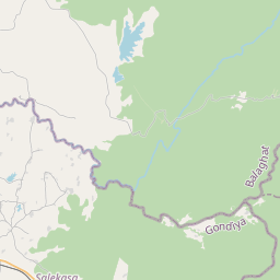
Distance Map Between Dongargarh and Durg
Dongargarh, Raipur, India ↔ Durg, Raipur, India = 34 miles = 55 km.


How far is it between Dongargarh and Durg
Dongargarh is located in India with (21.1885,80.756) coordinates and Durg is located in India with (21.1833,81.2833) coordinates. The calculated flying distance from Dongargarh to Durg is equal to 34 miles which is equal to 55 km.
If you want to go by car, the driving distance between Dongargarh and Durg is 67.1 km. If you ride your car with an average speed of 112 kilometers/hour (70 miles/h), travel time will be 00 hours 35 minutes. Please check the avg. speed travel time table on the right for various options.
Difference between fly and go by a car is 12 km.
| City/Place | Latitude and Longitude | GPS Coordinates |
|---|---|---|
| Dongargarh | 21.1885, 80.756 | 21° 11´ 18.6360'' N 80° 45´ 21.6000'' E |
| Durg | 21.1833, 81.2833 | 21° 10´ 59.9880'' N 81° 16´ 59.9880'' E |
Estimated Travel Time Between Dongargarh and Durg
| Average Speed | Travel Time |
|---|---|
| 30 mph (48 km/h) | 01 hours 23 minutes |
| 40 mph (64 km/h) | 01 hours 02 minutes |
| 50 mph (80 km/h) | 00 hours 50 minutes |
| 60 mph (97 km/h) | 00 hours 41 minutes |
| 70 mph (112 km/h) | 00 hours 35 minutes |
| 75 mph (120 km/h) | 00 hours 33 minutes |
Related Distances from Dongargarh
| Cities | Distance |
|---|---|
| Dongargarh to Khairagarh 2 | 42 km |
| Dongargarh to Mungeli | 162 km |
| Dongargarh to Kondagaon | 263 km |
| Dongargarh to Ratanpur | 230 km |
| Dongargarh to Kawardha | 118 km |
Related Distances to Durg
| Cities | Distance |
|---|---|
| Bemetara to Durg | 80 km |
| Arambagh to Durgapur | 106 km |
| Balod to Durg | 60 km |
| Barasat to Durgapur | 176 km |
| Bangaon to Durgapur | 197 km |