Distance from Douala to Kampene
Distance between Douala and Kampene is 2068 kilometers (1285 miles).
Driving distance from Douala to Kampene is 3478 kilometers (2161 miles).
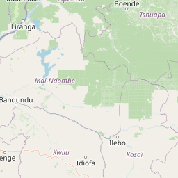
Distance Map Between Douala and Kampene
Douala, Cameroon ↔ Kampene, Kindu, Democratic Republic of the Congo = 1285 miles = 2068 km.


How far is it between Douala and Kampene
Douala is located in Cameroon with (4.0483,9.7043) coordinates and Kampene is located in Democratic Republic of the Congo with (-3.5968,26.6672) coordinates. The calculated flying distance from Douala to Kampene is equal to 1285 miles which is equal to 2068 km.
If you want to go by car, the driving distance between Douala and Kampene is 3477.64 km. If you ride your car with an average speed of 112 kilometers/hour (70 miles/h), travel time will be 31 hours 03 minutes. Please check the avg. speed travel time table on the right for various options.
Difference between fly and go by a car is 1410 km.
| City/Place | Latitude and Longitude | GPS Coordinates |
|---|---|---|
| Douala | 4.0483, 9.7043 | 4° 2´ 53.7720'' N 9° 42´ 15.4080'' E |
| Kampene | -3.5968, 26.6672 | 3° 35´ 48.4080'' S 26° 40´ 1.7400'' E |
Estimated Travel Time Between Douala and Kampene
| Average Speed | Travel Time |
|---|---|
| 30 mph (48 km/h) | 72 hours 27 minutes |
| 40 mph (64 km/h) | 54 hours 20 minutes |
| 50 mph (80 km/h) | 43 hours 28 minutes |
| 60 mph (97 km/h) | 35 hours 51 minutes |
| 70 mph (112 km/h) | 31 hours 03 minutes |
| 75 mph (120 km/h) | 28 hours 58 minutes |
Related Distances from Douala
| Cities | Distance |
|---|---|
| Douala to Kinshasa | 1896 km |
| Douala to Matadi | 2253 km |
| Douala to Goma | 3551 km |
| Douala to Mbuji Mayi | 4213 km |
| Douala to Bandundu | 2276 km |
Related Distances to Kampene
| Cities | Distance |
|---|---|
| Yaounde to Kampene | 3375 km |
| Douala to Kampene | 3478 km |