Distance from Dragasani to Budapest
Distance between Dragasani and Budapest is 512 kilometers (318 miles).
Driving distance from Dragasani to Budapest is 716 kilometers (445 miles).
Distance Map Between Dragasani and Budapest
Dragasani, Ramnicu Valcea, Romania ↔ Budapest, Hungary = 318 miles = 512 km.

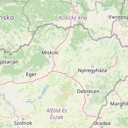


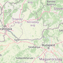


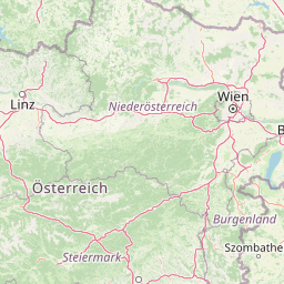


How far is it between Drăgăşani and Budapest
Dragasani is located in Romania with (44.65,24.2667) coordinates and Budapest is located in Hungary with (47.498,19.0399) coordinates. The calculated flying distance from Dragasani to Budapest is equal to 318 miles which is equal to 512 km.
If you want to go by car, the driving distance between Dragasani and Budapest is 716.29 km. If you ride your car with an average speed of 112 kilometers/hour (70 miles/h), travel time will be 06 hours 23 minutes. Please check the avg. speed travel time table on the right for various options.
Difference between fly and go by a car is 204 km.
| City/Place | Latitude and Longitude | GPS Coordinates |
|---|---|---|
| Dragasani | 44.65, 24.2667 | 44° 38´ 60.0000'' N 24° 16´ 0.0120'' E |
| Budapest | 47.498, 19.0399 | 47° 29´ 52.8360'' N 19° 2´ 23.6760'' E |
Estimated Travel Time Between Drăgăşani and Budapest
| Average Speed | Travel Time |
|---|---|
| 30 mph (48 km/h) | 14 hours 55 minutes |
| 40 mph (64 km/h) | 11 hours 11 minutes |
| 50 mph (80 km/h) | 08 hours 57 minutes |
| 60 mph (97 km/h) | 07 hours 23 minutes |
| 70 mph (112 km/h) | 06 hours 23 minutes |
| 75 mph (120 km/h) | 05 hours 58 minutes |
Related Distances from Dragasani
| Cities | Distance |
|---|---|
| Dragasani to Budapest | 716 km |
Related Distances to Budapest
| Cities | Distance |
|---|---|
| Bucharest to Budapest | 824 km |
| Timisoara to Budapest | 288 km |
| Cluj Napoca to Budapest | 466 km |
| Oradea to Budapest | 307 km |
| Arad to Budapest | 266 km |