Distance from Drogheda to Naas
Distance between Drogheda and Naas is 60 kilometers (37 miles).
Driving distance from Drogheda to Naas is 82 kilometers (51 miles).
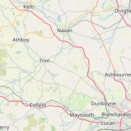
Distance Map Between Drogheda and Naas
Drogheda, Swords, Ireland ↔ Naas, Swords, Ireland = 37 miles = 60 km.


How far is it between Drogheda and Naas
Drogheda is located in Ireland with (53.7189,-6.3478) coordinates and Naas is located in Ireland with (53.2158,-6.6669) coordinates. The calculated flying distance from Drogheda to Naas is equal to 37 miles which is equal to 60 km.
If you want to go by car, the driving distance between Drogheda and Naas is 82.49 km. If you ride your car with an average speed of 112 kilometers/hour (70 miles/h), travel time will be 00 hours 44 minutes. Please check the avg. speed travel time table on the right for various options.
Difference between fly and go by a car is 22 km.
| City/Place | Latitude and Longitude | GPS Coordinates |
|---|---|---|
| Drogheda | 53.7189, -6.3478 | 53° 43´ 8.0040'' N 6° 20´ 52.0080'' W |
| Naas | 53.2158, -6.6669 | 53° 12´ 56.9880'' N 6° 40´ 0.9840'' W |
Estimated Travel Time Between Drogheda and Naas
| Average Speed | Travel Time |
|---|---|
| 30 mph (48 km/h) | 01 hours 43 minutes |
| 40 mph (64 km/h) | 01 hours 17 minutes |
| 50 mph (80 km/h) | 01 hours 01 minutes |
| 60 mph (97 km/h) | 00 hours 51 minutes |
| 70 mph (112 km/h) | 00 hours 44 minutes |
| 75 mph (120 km/h) | 00 hours 41 minutes |
Related Distances from Drogheda
| Cities | Distance |
|---|---|
| Drogheda to Dundalk 2 | 37 km |
| Drogheda to Navan | 27 km |
| Drogheda to Naas | 82 km |
| Drogheda to Tallaght | 66 km |
| Drogheda to Kilkenny | 174 km |
Related Distances to Naas
| Cities | Distance |
|---|---|
| Navan to Naas | 73 km |
| Carlow to Naas | 51 km |
| Lucan to Naas | 34 km |
| Drogheda to Naas | 82 km |
| Athlone to Naas | 115 km |