Distance from Echuca to Mulgrave
Distance between Echuca and Mulgrave is 201 kilometers (125 miles).
Driving distance from Echuca to Mulgrave is 251 kilometers (156 miles).
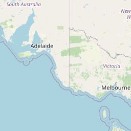
Distance Map Between Echuca and Mulgrave
Echuca, Melbourne, Australia ↔ Mulgrave, Melbourne, Australia = 125 miles = 201 km.

How far is it between Echuca and Mulgrave
Echuca is located in Australia with (-36.1406,144.7519) coordinates and Mulgrave is located in Australia with (-37.9167,145.2) coordinates. The calculated flying distance from Echuca to Mulgrave is equal to 125 miles which is equal to 201 km.
If you want to go by car, the driving distance between Echuca and Mulgrave is 251.31 km. If you ride your car with an average speed of 112 kilometers/hour (70 miles/h), travel time will be 02 hours 14 minutes. Please check the avg. speed travel time table on the right for various options.
Difference between fly and go by a car is 50 km.
| City/Place | Latitude and Longitude | GPS Coordinates |
|---|---|---|
| Echuca | -36.1406, 144.7519 | 36° 8´ 26.0520'' S 144° 45´ 6.6600'' E |
| Mulgrave | -37.9167, 145.2 | 37° 55´ 0.0120'' S 145° 11´ 60.0000'' E |
Estimated Travel Time Between Echuca and Mulgrave
| Average Speed | Travel Time |
|---|---|
| 30 mph (48 km/h) | 05 hours 14 minutes |
| 40 mph (64 km/h) | 03 hours 55 minutes |
| 50 mph (80 km/h) | 03 hours 08 minutes |
| 60 mph (97 km/h) | 02 hours 35 minutes |
| 70 mph (112 km/h) | 02 hours 14 minutes |
| 75 mph (120 km/h) | 02 hours 05 minutes |
Related Distances from Echuca
| Cities | Distance |
|---|---|
| Echuca to Shepparton | 71 km |
| Echuca to Geelong | 258 km |
| Echuca to Mildura | 373 km |
| Echuca to Wangaratta | 171 km |
| Echuca to Wodonga | 240 km |
Related Distances to Mulgrave
| Cities | Distance |
|---|---|
| Clayton 3 to Mulgrave | 8 km |
| Carnegie to Mulgrave | 17 km |
| Brighton East to Mulgrave | 17 km |
| Cranbourne to Mulgrave | 25 km |
| Bendigo to Mulgrave | 181 km |