Distance from Edgewater to Davie
Distance between Edgewater and Davie is 332 kilometers (206 miles).
Driving distance from Edgewater to Davie is 358 kilometers (222 miles).
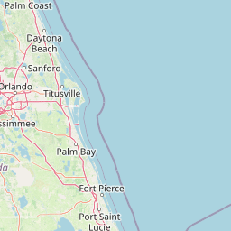
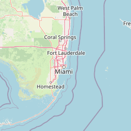
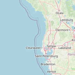
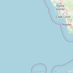
Distance Map Between Edgewater and Davie
Edgewater, Tallahassee, United States ↔ Davie, Tallahassee, United States = 206 miles = 332 km.


How far is it between Edgewater and Davie
Edgewater is located in United States with (28.9889,-80.9023) coordinates and Davie is located in United States with (26.0629,-80.2331) coordinates. The calculated flying distance from Edgewater to Davie is equal to 206 miles which is equal to 332 km.
If you want to go by car, the driving distance between Edgewater and Davie is 357.73 km. If you ride your car with an average speed of 112 kilometers/hour (70 miles/h), travel time will be 03 hours 11 minutes. Please check the avg. speed travel time table on the right for various options.
Difference between fly and go by a car is 26 km.
| City/Place | Latitude and Longitude | GPS Coordinates |
|---|---|---|
| Edgewater | 28.9889, -80.9023 | 28° 59´ 19.9680'' N 80° 54´ 8.2080'' W |
| Davie | 26.0629, -80.2331 | 26° 3´ 46.3320'' N 80° 13´ 59.1600'' W |
Estimated Travel Time Between Edgewater and Davie
| Average Speed | Travel Time |
|---|---|
| 30 mph (48 km/h) | 07 hours 27 minutes |
| 40 mph (64 km/h) | 05 hours 35 minutes |
| 50 mph (80 km/h) | 04 hours 28 minutes |
| 60 mph (97 km/h) | 03 hours 41 minutes |
| 70 mph (112 km/h) | 03 hours 11 minutes |
| 75 mph (120 km/h) | 02 hours 58 minutes |
Related Distances from Edgewater
| Cities | Distance |
|---|---|
| Edgewater to Deltona | 51 km |
| Edgewater to Daytona Beach | 29 km |
| Edgewater to Boca Raton | 331 km |
| Edgewater to Altamonte Springs | 82 km |
| Edgewater to Coral Gables | 399 km |
Related Distances to Davie
| Cities | Distance |
|---|---|
| Miami to Davie | 37 km |
| Deerfield Beach to Davie | 39 km |
| Miami Beach to Davie | 42 km |
| Sunrise to Davie | 22 km |
| Fort Lauderdale to Davie | 16 km |