Distance from El Paso to Cedar Park
Distance between El Paso and Cedar Park is 836 kilometers (520 miles).
Driving distance from El Paso to Cedar Park is 930 kilometers (578 miles).
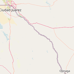
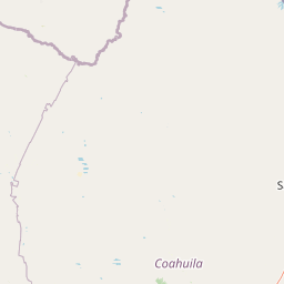
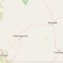
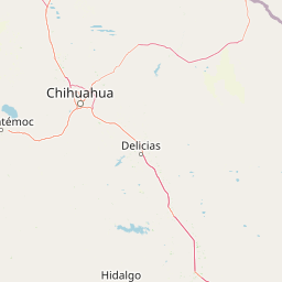
Distance Map Between El Paso and Cedar Park
El Paso, Austin, United States ↔ Cedar Park, Austin, United States = 520 miles = 836 km.


How far is it between El Paso and Cedar Park
El Paso is located in United States with (31.7587,-106.4869) coordinates and Cedar Park is located in United States with (30.5052,-97.8203) coordinates. The calculated flying distance from El Paso to Cedar Park is equal to 520 miles which is equal to 836 km.
If you want to go by car, the driving distance between El Paso and Cedar Park is 929.8 km. If you ride your car with an average speed of 112 kilometers/hour (70 miles/h), travel time will be 08 hours 18 minutes. Please check the avg. speed travel time table on the right for various options.
Difference between fly and go by a car is 94 km.
| City/Place | Latitude and Longitude | GPS Coordinates |
|---|---|---|
| El Paso | 31.7587, -106.4869 | 31° 45´ 31.3920'' N 106° 29´ 12.9480'' W |
| Cedar Park | 30.5052, -97.8203 | 30° 30´ 18.7200'' N 97° 49´ 13.0440'' W |
Estimated Travel Time Between El Paso and Cedar Park
| Average Speed | Travel Time |
|---|---|
| 30 mph (48 km/h) | 19 hours 22 minutes |
| 40 mph (64 km/h) | 14 hours 31 minutes |
| 50 mph (80 km/h) | 11 hours 37 minutes |
| 60 mph (97 km/h) | 09 hours 35 minutes |
| 70 mph (112 km/h) | 08 hours 18 minutes |
| 75 mph (120 km/h) | 07 hours 44 minutes |
Related Distances from El Paso
| Cities | Distance |
|---|---|
| El Paso to Houston | 1201 km |
| El Paso to San Antonio | 887 km |
| El Paso to Dallas | 1022 km |
| El Paso to Amarillo | 704 km |
| El Paso to Orange 5 | 1380 km |
Related Distances to Cedar Park
| Cities | Distance |
|---|---|
| Round Rock to Cedar Park | 19 km |
| Leander to Cedar Park | 9 km |
| Houston to Cedar Park | 276 km |
| Kyle to Cedar Park | 68 km |
| Pflugerville to Cedar Park | 27 km |