Distance from El Paso to Palau
Distance between El Paso and Palau is 651 kilometers (404 miles).
Driving distance from El Paso to Palau is 891 kilometers (554 miles).
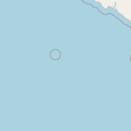
Distance Map Between El Paso and Palau
El Paso, Austin, United States ↔ Palau, Saltillo, Mexico = 404 miles = 651 km.


How far is it between El Paso and Palau
El Paso is located in United States with (31.7587,-106.4869) coordinates and Palau is located in Mexico with (27.8923,-101.4232) coordinates. The calculated flying distance from El Paso to Palau is equal to 404 miles which is equal to 651 km.
If you want to go by car, the driving distance between El Paso and Palau is 891.4 km. If you ride your car with an average speed of 112 kilometers/hour (70 miles/h), travel time will be 07 hours 57 minutes. Please check the avg. speed travel time table on the right for various options.
Difference between fly and go by a car is 240 km.
| City/Place | Latitude and Longitude | GPS Coordinates |
|---|---|---|
| El Paso | 31.7587, -106.4869 | 31° 45´ 31.3920'' N 106° 29´ 12.9480'' W |
| Palau | 27.8923, -101.4232 | 27° 53´ 32.3520'' N 101° 25´ 23.4840'' W |
Estimated Travel Time Between El Paso and Palau
| Average Speed | Travel Time |
|---|---|
| 30 mph (48 km/h) | 18 hours 34 minutes |
| 40 mph (64 km/h) | 13 hours 55 minutes |
| 50 mph (80 km/h) | 11 hours 08 minutes |
| 60 mph (97 km/h) | 09 hours 11 minutes |
| 70 mph (112 km/h) | 07 hours 57 minutes |
| 75 mph (120 km/h) | 07 hours 25 minutes |
Related Distances from El Paso
| Cities | Distance |
|---|---|
| El Paso to Chihuahua | 372 km |
| El Paso to Ciudad Juarez | 3 km |
| El Paso to Puerto Penasco | 845 km |
| El Paso to Mexico City | 1839 km |
| El Paso to Rio Grande 2 | 1072 km |
Related Distances to Palau
| Cities | Distance |
|---|---|
| Los Angeles to Palau | 2177 km |
| San Antonio to Palau | 373 km |
| San Diego to Palau | 2050 km |
| Phoenix to Palau | 1582 km |
| Chicago to Palau | 2330 km |