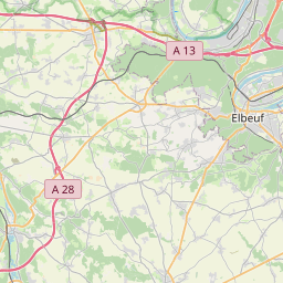
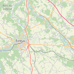
Distance from Elbeuf to Evreux
Distance between Elbeuf and Evreux is 31 kilometers (19 miles).
Driving distance from Elbeuf to Evreux is 41 kilometers (26 miles).
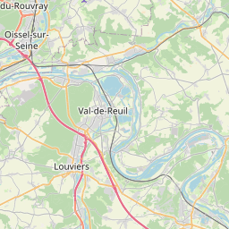
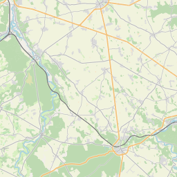
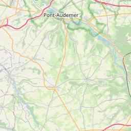
Distance Map Between Elbeuf and Evreux
Elbeuf, Rouen, France ↔ Evreux, Rouen, France = 19 miles = 31 km.

How far is it between Elbeuf and Évreux
Elbeuf is located in France with (49.2867,1.0029) coordinates and Evreux is located in France with (49.0241,1.1508) coordinates. The calculated flying distance from Elbeuf to Evreux is equal to 19 miles which is equal to 31 km.
If you want to go by car, the driving distance between Elbeuf and Evreux is 41.14 km. If you ride your car with an average speed of 112 kilometers/hour (70 miles/h), travel time will be 00 hours 22 minutes. Please check the avg. speed travel time table on the right for various options.
Difference between fly and go by a car is 10 km.
| City/Place | Latitude and Longitude | GPS Coordinates |
|---|---|---|
| Elbeuf | 49.2867, 1.0029 | 49° 17´ 12.0840'' N 1° 0´ 10.3680'' E |
| Evreux | 49.0241, 1.1508 | 49° 1´ 26.9040'' N 1° 9´ 2.9520'' E |
Estimated Travel Time Between Elbeuf and Évreux
| Average Speed | Travel Time |
|---|---|
| 30 mph (48 km/h) | 00 hours 51 minutes |
| 40 mph (64 km/h) | 00 hours 38 minutes |
| 50 mph (80 km/h) | 00 hours 30 minutes |
| 60 mph (97 km/h) | 00 hours 25 minutes |
| 70 mph (112 km/h) | 00 hours 22 minutes |
| 75 mph (120 km/h) | 00 hours 20 minutes |
Related Distances from Elbeuf
| Cities | Distance |
|---|---|
| Elbeuf to Le Havre | 82 km |
| Elbeuf to Sotteville Les Rouen | 18 km |
| Elbeuf to Mont Saint Aignan | 25 km |
| Elbeuf to Le Petit Quevilly | 19 km |
| Elbeuf to Vernon 2 | 52 km |
Related Distances to Evreux
| Cities | Distance |
|---|---|
| Dieppe to Evreux | 125 km |
| Cayenne 2 to Evreux | 109 km |
| Canteleu to Evreux | 62 km |
| Elbeuf to Evreux | 41 km |