Distance from Entebbe to Masaka
Distance between Entebbe and Masaka is 91 kilometers (56 miles).
Driving distance from Entebbe to Masaka is 119 kilometers (74 miles).
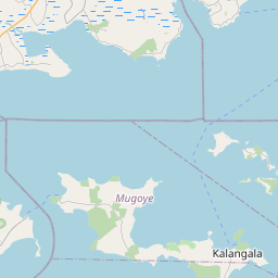
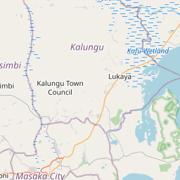
Distance Map Between Entebbe and Masaka
Entebbe, Kampala, Uganda ↔ Masaka, Kampala, Uganda = 56 miles = 91 km.


How far is it between Entebbe and Masaka
Entebbe is located in Uganda with (0.0644,32.4469) coordinates and Masaka is located in Uganda with (-0.3338,31.7341) coordinates. The calculated flying distance from Entebbe to Masaka is equal to 56 miles which is equal to 91 km.
If you want to go by car, the driving distance between Entebbe and Masaka is 119.24 km. If you ride your car with an average speed of 112 kilometers/hour (70 miles/h), travel time will be 01 hours 03 minutes. Please check the avg. speed travel time table on the right for various options.
Difference between fly and go by a car is 28 km.
| City/Place | Latitude and Longitude | GPS Coordinates |
|---|---|---|
| Entebbe | 0.0644, 32.4469 | 0° 3´ 51.9840'' N 32° 26´ 48.9840'' E |
| Masaka | -0.3338, 31.7341 | 0° 20´ 1.6440'' S 31° 44´ 2.7240'' E |
Estimated Travel Time Between Entebbe and Masaka
| Average Speed | Travel Time |
|---|---|
| 30 mph (48 km/h) | 02 hours 29 minutes |
| 40 mph (64 km/h) | 01 hours 51 minutes |
| 50 mph (80 km/h) | 01 hours 29 minutes |
| 60 mph (97 km/h) | 01 hours 13 minutes |
| 70 mph (112 km/h) | 01 hours 03 minutes |
| 75 mph (120 km/h) | 00 hours 59 minutes |
Related Distances from Entebbe
| Cities | Distance |
|---|---|
| Entebbe to Jinja | 116 km |
| Entebbe to Masaka | 119 km |
| Entebbe to Mukono | 67 km |
| Entebbe to Wakiso | 58 km |
| Entebbe to Luwero | 104 km |
Related Distances to Masaka
| Cities | Distance |
|---|---|
| Kampala to Masaka | 134 km |
| Mbarara to Masaka | 135 km |
| Entebbe to Masaka | 119 km |
| Luwero to Masaka | 186 km |
| Lugazi to Masaka | 177 km |