Distance from Erftstadt to Herne
Distance between Erftstadt and Herne is 86 kilometers (53 miles).
Driving distance from Erftstadt to Herne is 109 kilometers (68 miles).
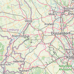
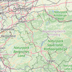
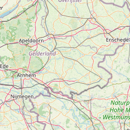
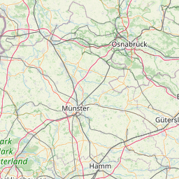
Distance Map Between Erftstadt and Herne
Erftstadt, Dusseldorf, Germany ↔ Herne, Dusseldorf, Germany = 53 miles = 86 km.


How far is it between Erftstadt and Herne
Erftstadt is located in Germany with (50.8148,6.7939) coordinates and Herne is located in Germany with (51.5388,7.2257) coordinates. The calculated flying distance from Erftstadt to Herne is equal to 53 miles which is equal to 86 km.
If you want to go by car, the driving distance between Erftstadt and Herne is 109.49 km. If you ride your car with an average speed of 112 kilometers/hour (70 miles/h), travel time will be 00 hours 58 minutes. Please check the avg. speed travel time table on the right for various options.
Difference between fly and go by a car is 23 km.
| City/Place | Latitude and Longitude | GPS Coordinates |
|---|---|---|
| Erftstadt | 50.8148, 6.7939 | 50° 48´ 53.3160'' N 6° 47´ 37.9320'' E |
| Herne | 51.5388, 7.2257 | 51° 32´ 19.6800'' N 7° 13´ 32.5920'' E |
Estimated Travel Time Between Erftstadt and Herne
| Average Speed | Travel Time |
|---|---|
| 30 mph (48 km/h) | 02 hours 16 minutes |
| 40 mph (64 km/h) | 01 hours 42 minutes |
| 50 mph (80 km/h) | 01 hours 22 minutes |
| 60 mph (97 km/h) | 01 hours 07 minutes |
| 70 mph (112 km/h) | 00 hours 58 minutes |
| 75 mph (120 km/h) | 00 hours 54 minutes |
Related Distances from Erftstadt
| Cities | Distance |
|---|---|
| Erftstadt to Troisdorf | 52 km |
| Erftstadt to Lindlar | 68 km |
| Erftstadt to Koeln | 27 km |
| Erftstadt to Muelheim Ruhr | 94 km |
| Erftstadt to Essen | 94 km |
Related Distances to Herne
| Cities | Distance |
|---|---|
| Dortmund to Herne | 24 km |
| Bochum to Herne | 9 km |
| Essen to Herne | 24 km |
| Hamm to Herne | 56 km |
| Bonn to Herne | 112 km |