Distance from Escuintla to Flores
Distance between Escuintla and Flores is 306 kilometers (190 miles).
Driving distance from Escuintla to Flores is 544 kilometers (338 miles).
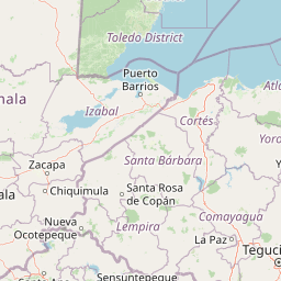
Distance Map Between Escuintla and Flores
Escuintla, Guatemala ↔ Flores, Guatemala = 190 miles = 306 km.


How far is it between Escuintla and Flores
Escuintla is located in Guatemala with (14.305,-90.785) coordinates and Flores is located in Guatemala with (16.9226,-89.8994) coordinates. The calculated flying distance from Escuintla to Flores is equal to 190 miles which is equal to 306 km.
If you want to go by car, the driving distance between Escuintla and Flores is 543.91 km. If you ride your car with an average speed of 112 kilometers/hour (70 miles/h), travel time will be 04 hours 51 minutes. Please check the avg. speed travel time table on the right for various options.
Difference between fly and go by a car is 238 km.
| City/Place | Latitude and Longitude | GPS Coordinates |
|---|---|---|
| Escuintla | 14.305, -90.785 | 14° 18´ 18.0000'' N 90° 47´ 6.0000'' W |
| Flores | 16.9226, -89.8994 | 16° 55´ 21.2880'' N 89° 53´ 57.8760'' W |
Estimated Travel Time Between Escuintla and Flores
| Average Speed | Travel Time |
|---|---|
| 30 mph (48 km/h) | 11 hours 19 minutes |
| 40 mph (64 km/h) | 08 hours 29 minutes |
| 50 mph (80 km/h) | 06 hours 47 minutes |
| 60 mph (97 km/h) | 05 hours 36 minutes |
| 70 mph (112 km/h) | 04 hours 51 minutes |
| 75 mph (120 km/h) | 04 hours 31 minutes |
Related Distances from Escuintla
| Cities | Distance |
|---|---|
| Escuintla to Puerto Barrios | 357 km |
| Escuintla to Quetzaltenango | 152 km |
| Escuintla to Zacapa | 211 km |
| Escuintla to San Marcos 5 | 213 km |
| Escuintla to Retalhuleu | 130 km |
Related Distances to Flores
| Cities | Distance |
|---|---|
| Guatemala City to Flores | 483 km |
| Antigua Guatemala to Flores | 522 km |
| Coban to Flores | 261 km |
| Chiquimula to Flores | 380 km |
| Escuintla to Flores | 544 km |