Distance from Etawah to Pinahat
Distance between Etawah and Pinahat is 65 kilometers (41 miles).
Driving distance from Etawah to Pinahat is 74 kilometers (46 miles).
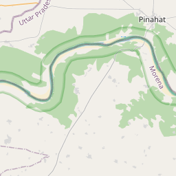
Distance Map Between Etawah and Pinahat
Etawah, Lucknow, India ↔ Pinahat, Lucknow, India = 41 miles = 65 km.


How far is it between Etāwah and Pināhat
Etawah is located in India with (26.7778,79.0216) coordinates and Pinahat is located in India with (26.8851,78.375) coordinates. The calculated flying distance from Etawah to Pinahat is equal to 41 miles which is equal to 65 km.
If you want to go by car, the driving distance between Etawah and Pinahat is 73.86 km. If you ride your car with an average speed of 112 kilometers/hour (70 miles/h), travel time will be 00 hours 39 minutes. Please check the avg. speed travel time table on the right for various options.
Difference between fly and go by a car is 9 km.
| City/Place | Latitude and Longitude | GPS Coordinates |
|---|---|---|
| Etawah | 26.7778, 79.0216 | 26° 46´ 40.0800'' N 79° 1´ 17.7240'' E |
| Pinahat | 26.8851, 78.375 | 26° 53´ 6.4680'' N 78° 22´ 29.8560'' E |
Estimated Travel Time Between Etāwah and Pināhat
| Average Speed | Travel Time |
|---|---|
| 30 mph (48 km/h) | 01 hours 32 minutes |
| 40 mph (64 km/h) | 01 hours 09 minutes |
| 50 mph (80 km/h) | 00 hours 55 minutes |
| 60 mph (97 km/h) | 00 hours 45 minutes |
| 70 mph (112 km/h) | 00 hours 39 minutes |
| 75 mph (120 km/h) | 00 hours 36 minutes |
Related Distances from Etawah
| Cities | Distance |
|---|---|
| Etawah to Jaswantnagar | 17 km |
| Etawah to Sirsaganj | 48 km |
| Etawah to Karhal | 27 km |
| Etawah to Kalpi | 121 km |
| Etawah to Sikandra Rao | 143 km |
Related Distances to Pinahat
| Cities | Distance |
|---|---|
| Agra to Pinahat | 53 km |
| Etawah to Pinahat | 74 km |
| Firozabad to Pinahat | 37 km |
| Mainpuri to Pinahat | 102 km |
| Mathura to Pinahat | 134 km |