Distance from Fairhope to Bessemer
Distance between Fairhope and Bessemer is 332 kilometers (207 miles).
Driving distance from Fairhope to Bessemer is 423 kilometers (263 miles).
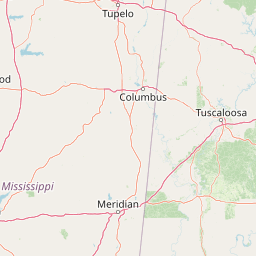
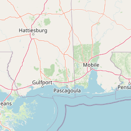
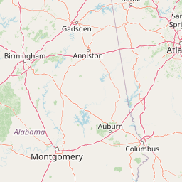
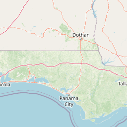
Distance Map Between Fairhope and Bessemer
Fairhope, Montgomery, United States ↔ Bessemer, Montgomery, United States = 207 miles = 332 km.


How far is it between Fairhope and Bessemer
Fairhope is located in United States with (30.523,-87.9033) coordinates and Bessemer is located in United States with (33.4018,-86.9544) coordinates. The calculated flying distance from Fairhope to Bessemer is equal to 207 miles which is equal to 332 km.
If you want to go by car, the driving distance between Fairhope and Bessemer is 422.6 km. If you ride your car with an average speed of 112 kilometers/hour (70 miles/h), travel time will be 03 hours 46 minutes. Please check the avg. speed travel time table on the right for various options.
Difference between fly and go by a car is 91 km.
| City/Place | Latitude and Longitude | GPS Coordinates |
|---|---|---|
| Fairhope | 30.523, -87.9033 | 30° 31´ 22.6920'' N 87° 54´ 11.9880'' W |
| Bessemer | 33.4018, -86.9544 | 33° 24´ 6.4080'' N 86° 57´ 15.9840'' W |
Estimated Travel Time Between Fairhope and Bessemer
| Average Speed | Travel Time |
|---|---|
| 30 mph (48 km/h) | 08 hours 48 minutes |
| 40 mph (64 km/h) | 06 hours 36 minutes |
| 50 mph (80 km/h) | 05 hours 16 minutes |
| 60 mph (97 km/h) | 04 hours 21 minutes |
| 70 mph (112 km/h) | 03 hours 46 minutes |
| 75 mph (120 km/h) | 03 hours 31 minutes |
Related Distances from Fairhope
| Cities | Distance |
|---|---|
| Fairhope to Daphne | 9 km |
| Fairhope to Birmingham 2 | 421 km |
| Fairhope to Dothan | 308 km |
| Fairhope to Enterprise 2 | 272 km |
| Fairhope to Decatur 2 | 557 km |
Related Distances to Bessemer
| Cities | Distance |
|---|---|
| Tuscaloosa to Bessemer | 72 km |
| Hoover to Bessemer | 24 km |
| Center Point to Bessemer | 45 km |
| Alabaster to Bessemer | 28 km |
| Pelham to Bessemer | 26 km |