Distance from Figueres to Gava
Distance between Figueres and Gava is 133 kilometers (83 miles).
Driving distance from Figueres to Gava is 157 kilometers (98 miles).
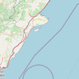
Distance Map Between Figueres and Gava
Figueres, Barcelona, Spain ↔ Gava, Barcelona, Spain = 83 miles = 133 km.


How far is it between Figueres and Gavà
Figueres is located in Spain with (42.2665,2.9616) coordinates and Gava is located in Spain with (41.3061,2.0012) coordinates. The calculated flying distance from Figueres to Gava is equal to 83 miles which is equal to 133 km.
If you want to go by car, the driving distance between Figueres and Gava is 157.26 km. If you ride your car with an average speed of 112 kilometers/hour (70 miles/h), travel time will be 01 hours 24 minutes. Please check the avg. speed travel time table on the right for various options.
Difference between fly and go by a car is 24 km.
| City/Place | Latitude and Longitude | GPS Coordinates |
|---|---|---|
| Figueres | 42.2665, 2.9616 | 42° 15´ 59.2200'' N 2° 57´ 41.8680'' E |
| Gava | 41.3061, 2.0012 | 41° 18´ 21.7800'' N 2° 0´ 4.4280'' E |
Estimated Travel Time Between Figueres and Gavà
| Average Speed | Travel Time |
|---|---|
| 30 mph (48 km/h) | 03 hours 16 minutes |
| 40 mph (64 km/h) | 02 hours 27 minutes |
| 50 mph (80 km/h) | 01 hours 57 minutes |
| 60 mph (97 km/h) | 01 hours 37 minutes |
| 70 mph (112 km/h) | 01 hours 24 minutes |
| 75 mph (120 km/h) | 01 hours 18 minutes |
Related Distances from Figueres
| Cities | Distance |
|---|---|
| Figueres to Roses | 21 km |
| Figueres to Girona | 44 km |
| Figueres to Barcelona | 139 km |
| Figueres to Tarragona | 229 km |
| Figueres to Pineda De Mar | 85 km |
Related Distances to Gava
| Cities | Distance |
|---|---|
| Castelldefels to Gava | 8 km |
| Sarria Sant Gervasi to Gava | 22 km |
| Ciutat Vella to Gava | 22 km |
| Banyoles to Gava | 138 km |
| Cornella De Llobregat to Gava | 13 km |