Distance from Fort Bragg to Durham
Distance between Fort Bragg and Durham is 96 kilometers (59 miles).
Driving distance from Fort Bragg to Durham is 129 kilometers (80 miles).
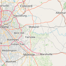
Distance Map Between Fort Bragg and Durham
Fort Bragg, Raleigh, United States ↔ Durham, Raleigh, United States = 59 miles = 96 km.


How far is it between Fort Bragg and Durham
Fort Bragg is located in United States with (35.139,-79.006) coordinates and Durham is located in United States with (35.994,-78.8986) coordinates. The calculated flying distance from Fort Bragg to Durham is equal to 59 miles which is equal to 96 km.
If you want to go by car, the driving distance between Fort Bragg and Durham is 128.81 km. If you ride your car with an average speed of 112 kilometers/hour (70 miles/h), travel time will be 01 hours 09 minutes. Please check the avg. speed travel time table on the right for various options.
Difference between fly and go by a car is 33 km.
| City/Place | Latitude and Longitude | GPS Coordinates |
|---|---|---|
| Fort Bragg | 35.139, -79.006 | 35° 8´ 20.4000'' N 79° 0´ 21.7080'' W |
| Durham | 35.994, -78.8986 | 35° 59´ 38.5080'' N 78° 53´ 55.0320'' W |
Estimated Travel Time Between Fort Bragg and Durham
| Average Speed | Travel Time |
|---|---|
| 30 mph (48 km/h) | 02 hours 41 minutes |
| 40 mph (64 km/h) | 02 hours 00 minutes |
| 50 mph (80 km/h) | 01 hours 36 minutes |
| 60 mph (97 km/h) | 01 hours 19 minutes |
| 70 mph (112 km/h) | 01 hours 09 minutes |
| 75 mph (120 km/h) | 01 hours 04 minutes |
Related Distances from Fort Bragg
| Cities | Distance |
|---|---|
| Fort Bragg to Charlotte | 200 km |
| Fort Bragg to Fayetteville | 21 km |
| Fort Bragg to Asheville | 414 km |
| Fort Bragg to New Bern | 201 km |
| Fort Bragg to Wilmington | 161 km |
Related Distances to Durham
| Cities | Distance |
|---|---|
| Winston Salem to Durham | 129 km |
| Wilmington to Durham | 252 km |
| Wake Forest to Durham | 37 km |
| Fayetteville to Durham | 143 km |
| Greensboro to Durham | 86 km |