Distance from Fountain to Englewood
Distance between Fountain and Englewood is 110 kilometers (68 miles).
Driving distance from Fountain to Englewood is 127 kilometers (79 miles).
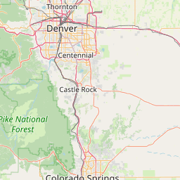
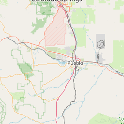
Distance Map Between Fountain and Englewood
Fountain, Denver, United States ↔ Englewood, Denver, United States = 68 miles = 110 km.


How far is it between Fountain and Englewood
Fountain is located in United States with (38.6822,-104.7008) coordinates and Englewood is located in United States with (39.6478,-104.9878) coordinates. The calculated flying distance from Fountain to Englewood is equal to 68 miles which is equal to 110 km.
If you want to go by car, the driving distance between Fountain and Englewood is 126.58 km. If you ride your car with an average speed of 112 kilometers/hour (70 miles/h), travel time will be 01 hours 07 minutes. Please check the avg. speed travel time table on the right for various options.
Difference between fly and go by a car is 17 km.
| City/Place | Latitude and Longitude | GPS Coordinates |
|---|---|---|
| Fountain | 38.6822, -104.7008 | 38° 40´ 55.9920'' N 104° 42´ 2.9160'' W |
| Englewood | 39.6478, -104.9878 | 39° 38´ 51.9720'' N 104° 59´ 15.9360'' W |
Estimated Travel Time Between Fountain and Englewood
| Average Speed | Travel Time |
|---|---|
| 30 mph (48 km/h) | 02 hours 38 minutes |
| 40 mph (64 km/h) | 01 hours 58 minutes |
| 50 mph (80 km/h) | 01 hours 34 minutes |
| 60 mph (97 km/h) | 01 hours 18 minutes |
| 70 mph (112 km/h) | 01 hours 07 minutes |
| 75 mph (120 km/h) | 01 hours 03 minutes |
Related Distances from Fountain
| Cities | Distance |
|---|---|
| Fountain to Colorado Springs | 23 km |
| Fountain to Castle Rock | 88 km |
| Fountain to Canon City | 83 km |
| Fountain to Arvada | 151 km |
| Fountain to Durango 2 | 485 km |
Related Distances to Englewood
| Cities | Distance |
|---|---|
| Lakewood to Englewood | 15 km |
| Westminster to Englewood | 28 km |
| Jersey City to Englewood 2 | 31 km |
| Teaneck to Englewood 2 | 7 km |
| Littleton to Englewood | 6 km |