Distance from Fuxin to Yingkou
Distance between Fuxin and Yingkou is 160 kilometers (100 miles).
Driving distance from Fuxin to Yingkou is 196 kilometers (122 miles).
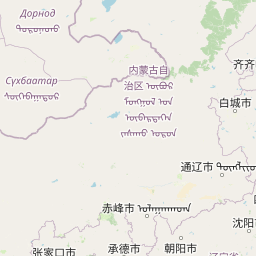
Distance Map Between Fuxin and Yingkou
Fuxin, Shenyang, China ↔ Yingkou, Shenyang, China = 100 miles = 160 km.


How far is it between Fuxin and Yingkou
Fuxin is located in China with (42.0589,121.745) coordinates and Yingkou is located in China with (40.6648,122.2283) coordinates. The calculated flying distance from Fuxin to Yingkou is equal to 100 miles which is equal to 160 km.
If you want to go by car, the driving distance between Fuxin and Yingkou is 195.71 km. If you ride your car with an average speed of 112 kilometers/hour (70 miles/h), travel time will be 01 hours 44 minutes. Please check the avg. speed travel time table on the right for various options.
Difference between fly and go by a car is 36 km.
| City/Place | Latitude and Longitude | GPS Coordinates |
|---|---|---|
| Fuxin | 42.0589, 121.745 | 42° 3´ 32.0040'' N 121° 44´ 42.0000'' E |
| Yingkou | 40.6648, 122.2283 | 40° 39´ 53.3520'' N 122° 13´ 41.9880'' E |
Estimated Travel Time Between Fuxin and Yingkou
| Average Speed | Travel Time |
|---|---|
| 30 mph (48 km/h) | 04 hours 04 minutes |
| 40 mph (64 km/h) | 03 hours 03 minutes |
| 50 mph (80 km/h) | 02 hours 26 minutes |
| 60 mph (97 km/h) | 02 hours 01 minutes |
| 70 mph (112 km/h) | 01 hours 44 minutes |
| 75 mph (120 km/h) | 01 hours 37 minutes |
Related Distances from Fuxin
| Cities | Distance |
|---|---|
| Fuxin 2 to Jinzhou | 153 km |
| Fuxin 2 to Dalian | 408 km |
| Fuxin 2 to Tieling | 219 km |
| Fuxin 2 to Dalianwan | 399 km |
| Fuxin 2 to Jiupu | 235 km |
Related Distances to Yingkou
| Cities | Distance |
|---|---|
| Jinzhou to Yingkou | 165 km |
| Haicheng to Yingkou | 59 km |
| Anshan to Yingkou | 99 km |
| Xinmin to Yingkou | 218 km |
| Liaoyang to Yingkou | 121 km |