Distance from Gainesville to Guadalupe
Distance between Gainesville and Guadalupe is 1818 kilometers (1130 miles).
Driving distance from Gainesville to Guadalupe is 2138 kilometers (1329 miles).
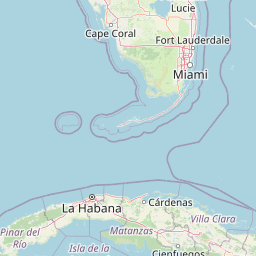
Distance Map Between Gainesville and Guadalupe
Gainesville, Tallahassee, United States ↔ Guadalupe, Monterrey, Mexico = 1130 miles = 1818 km.


How far is it between Gainesville and Guadalupe
Gainesville is located in United States with (29.6516,-82.3248) coordinates and Guadalupe is located in Mexico with (25.6768,-100.2565) coordinates. The calculated flying distance from Gainesville to Guadalupe is equal to 1130 miles which is equal to 1818 km.
If you want to go by car, the driving distance between Gainesville and Guadalupe is 2138.18 km. If you ride your car with an average speed of 112 kilometers/hour (70 miles/h), travel time will be 19 hours 05 minutes. Please check the avg. speed travel time table on the right for various options.
Difference between fly and go by a car is 320 km.
| City/Place | Latitude and Longitude | GPS Coordinates |
|---|---|---|
| Gainesville | 29.6516, -82.3248 | 29° 39´ 5.8680'' N 82° 19´ 29.3880'' W |
| Guadalupe | 25.6768, -100.2565 | 25° 40´ 36.4080'' N 100° 15´ 23.2560'' W |
Estimated Travel Time Between Gainesville and Guadalupe
| Average Speed | Travel Time |
|---|---|
| 30 mph (48 km/h) | 44 hours 32 minutes |
| 40 mph (64 km/h) | 33 hours 24 minutes |
| 50 mph (80 km/h) | 26 hours 43 minutes |
| 60 mph (97 km/h) | 22 hours 02 minutes |
| 70 mph (112 km/h) | 19 hours 05 minutes |
| 75 mph (120 km/h) | 17 hours 49 minutes |
Related Distances from Gainesville
| Cities | Distance |
|---|---|
| Gainesville to Leon | 2774 km |
| Gainesville to Mexico City | 2992 km |
| Gainesville to Monterrey | 2174 km |
| Gainesville to Puebla | 2914 km |
| Gainesville to Guadalupe | 2138 km |
Related Distances to Guadalupe
| Cities | Distance |
|---|---|
| Los Angeles to Guadalupe | 2471 km |
| Houston to Guadalupe | 801 km |
| Austin to Guadalupe | 616 km |
| Paris 2 to Guadalupe | 1097 km |
| San Diego to Guadalupe | 2346 km |