Distance from Garoowe to Marka
Distance between Garoowe and Marka is 849 kilometers (528 miles).
Driving distance from Garoowe to Marka is 1036 kilometers (644 miles).
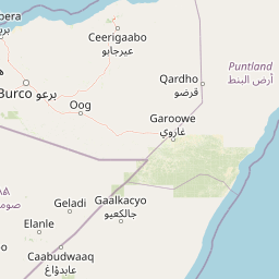
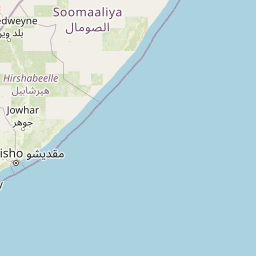
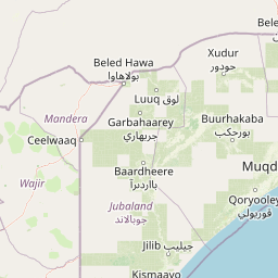
Distance Map Between Garoowe and Marka
Garoowe, Somalia ↔ Marka, Somalia = 528 miles = 849 km.


How far is it between Garoowe and Marka
Garoowe is located in Somalia with (8.4021,48.4828) coordinates and Marka is located in Somalia with (1.7159,44.7717) coordinates. The calculated flying distance from Garoowe to Marka is equal to 528 miles which is equal to 849 km.
If you want to go by car, the driving distance between Garoowe and Marka is 1036.31 km. If you ride your car with an average speed of 112 kilometers/hour (70 miles/h), travel time will be 09 hours 15 minutes. Please check the avg. speed travel time table on the right for various options.
Difference between fly and go by a car is 187 km.
| City/Place | Latitude and Longitude | GPS Coordinates |
|---|---|---|
| Garoowe | 8.4021, 48.4828 | 8° 24´ 7.4520'' N 48° 28´ 58.2240'' E |
| Marka | 1.7159, 44.7717 | 1° 42´ 57.3840'' N 44° 46´ 17.9760'' E |
Estimated Travel Time Between Garoowe and Marka
| Average Speed | Travel Time |
|---|---|
| 30 mph (48 km/h) | 21 hours 35 minutes |
| 40 mph (64 km/h) | 16 hours 11 minutes |
| 50 mph (80 km/h) | 12 hours 57 minutes |
| 60 mph (97 km/h) | 10 hours 41 minutes |
| 70 mph (112 km/h) | 09 hours 15 minutes |
| 75 mph (120 km/h) | 08 hours 38 minutes |
Related Distances from Garoowe
| Cities | Distance |
|---|---|
| Garoowe to Mogadishu | 945 km |
| Garoowe to Hargeysa | 566 km |
| Garoowe to Kismayo | 1426 km |
| Garoowe to Marka | 1036 km |
| Garoowe to Jawhar | 854 km |
Related Distances to Marka
| Cities | Distance |
|---|---|
| Mogadishu to Marka | 95 km |
| Jilib to Marka | 287 km |
| Baidoa to Marka | 284 km |
| Gaalkacyo to Marka | 807 km |
| Hargeysa to Marka | 1550 km |