Distance from Gohad to Jora
Distance between Gohad and Jora is 64 kilometers (40 miles).
Driving distance from Gohad to Jora is 92 kilometers (57 miles).
Distance Map Between Gohad and Jora
Gohad, Bhopal, India ↔ Jora, Bhopal, India = 40 miles = 64 km.

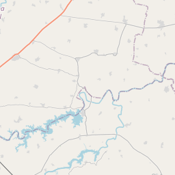


Leaflet | © OpenStreetMap
How far is it between Gohad and Jora
Gohad is located in India with (26.4242,78.4409) coordinates and Jora is located in India with (26.3421,77.8092) coordinates. The calculated flying distance from Gohad to Jora is equal to 40 miles which is equal to 64 km.
If you want to go by car, the driving distance between Gohad and Jora is 92.28 km. If you ride your car with an average speed of 112 kilometers/hour (70 miles/h), travel time will be 00 hours 49 minutes. Please check the avg. speed travel time table on the right for various options.
Difference between fly and go by a car is 28 km.
| City/Place | Latitude and Longitude | GPS Coordinates |
|---|---|---|
| Gohad | 26.4242, 78.4409 | 26° 25´ 26.9760'' N 78° 26´ 27.3480'' E |
| Jora | 26.3421, 77.8092 | 26° 20´ 31.5240'' N 77° 48´ 33.1200'' E |
Estimated Travel Time Between Gohad and Jora
| Average Speed | Travel Time |
|---|---|
| 30 mph (48 km/h) | 01 hours 55 minutes |
| 40 mph (64 km/h) | 01 hours 26 minutes |
| 50 mph (80 km/h) | 01 hours 09 minutes |
| 60 mph (97 km/h) | 00 hours 57 minutes |
| 70 mph (112 km/h) | 00 hours 49 minutes |
| 75 mph (120 km/h) | 00 hours 46 minutes |
Gohad, Bhopal, India
Related Distances from Gohad
| Cities | Distance |
|---|---|
| Gohad to Gwalior | 44 km |
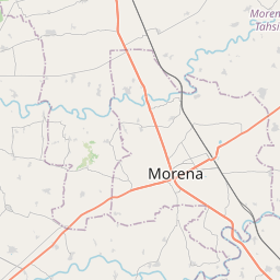
| Gohad to Morena | 68 km |
| Gohad to Mau 2 | 32 km |
| Gohad to Lahar | 76 km |
| Gohad to Narwar | 159 km |
Jora, Bhopal, India
Related Distances to Jora
| Cities | Distance |
|---|---|
| Gwalior to Jora | 62 km |
| Bhind to Jora | 126 km |
| Ambah to Jora | 60 km |
| Jaora to Jora | 550 km |
| Amla to Jora | 779 km |