Distance from Gohad to Samthar
Distance between Gohad and Samthar is 80 kilometers (49 miles).
Driving distance from Gohad to Samthar is 97 kilometers (60 miles).
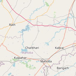
Distance Map Between Gohad and Samthar
Gohad, Bhopal, India ↔ Samthar, Bhopal, India = 49 miles = 80 km.


How far is it between Gohad and Samthar
Gohad is located in India with (26.4242,78.4409) coordinates and Samthar is located in India with (25.8433,78.9058) coordinates. The calculated flying distance from Gohad to Samthar is equal to 49 miles which is equal to 80 km.
If you want to go by car, the driving distance between Gohad and Samthar is 96.71 km. If you ride your car with an average speed of 112 kilometers/hour (70 miles/h), travel time will be 00 hours 51 minutes. Please check the avg. speed travel time table on the right for various options.
Difference between fly and go by a car is 17 km.
| City/Place | Latitude and Longitude | GPS Coordinates |
|---|---|---|
| Gohad | 26.4242, 78.4409 | 26° 25´ 26.9760'' N 78° 26´ 27.3480'' E |
| Samthar | 25.8433, 78.9058 | 25° 50´ 35.9160'' N 78° 54´ 20.9520'' E |
Estimated Travel Time Between Gohad and Samthar
| Average Speed | Travel Time |
|---|---|
| 30 mph (48 km/h) | 02 hours 00 minutes |
| 40 mph (64 km/h) | 01 hours 30 minutes |
| 50 mph (80 km/h) | 01 hours 12 minutes |
| 60 mph (97 km/h) | 00 hours 59 minutes |
| 70 mph (112 km/h) | 00 hours 51 minutes |
| 75 mph (120 km/h) | 00 hours 48 minutes |
Related Distances from Gohad
| Cities | Distance |
|---|---|
| Gohad to Gwalior | 44 km |
| Gohad to Morena | 68 km |
| Gohad to Mau 2 | 32 km |
| Gohad to Lahar | 76 km |
| Gohad to Narwar | 159 km |
Related Distances to Samthar
| Cities | Distance |
|---|---|
| Datia to Samthar | 62 km |
| Gwalior to Samthar | 126 km |
| Dabra to Samthar | 92 km |
| Bhind to Samthar | 101 km |
| Morena to Samthar | 166 km |