Distance from Goiana to Paulista
Distance between Goiana and Paulista is 45 kilometers (28 miles).
Driving distance from Goiana to Paulista is 50 kilometers (31 miles).
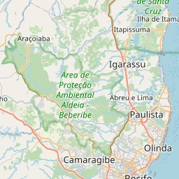
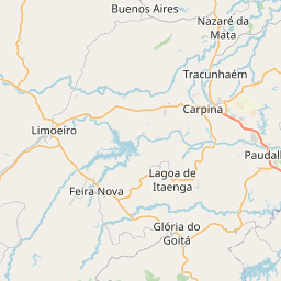
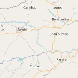
Distance Map Between Goiana and Paulista
Goiana, Recife, Brazil ↔ Paulista, Recife, Brazil = 28 miles = 45 km.


How far is it between Goiana and Paulista
Goiana is located in Brazil with (-7.5606,-35.0025) coordinates and Paulista is located in Brazil with (-7.9408,-34.8731) coordinates. The calculated flying distance from Goiana to Paulista is equal to 28 miles which is equal to 45 km.
If you want to go by car, the driving distance between Goiana and Paulista is 49.71 km. If you ride your car with an average speed of 112 kilometers/hour (70 miles/h), travel time will be 00 hours 26 minutes. Please check the avg. speed travel time table on the right for various options.
Difference between fly and go by a car is 5 km.
| City/Place | Latitude and Longitude | GPS Coordinates |
|---|---|---|
| Goiana | -7.5606, -35.0025 | 7° 33´ 38.0160'' S 35° 0´ 9.0000'' W |
| Paulista | -7.9408, -34.8731 | 7° 56´ 26.9880'' S 34° 52´ 23.0160'' W |
Estimated Travel Time Between Goiana and Paulista
| Average Speed | Travel Time |
|---|---|
| 30 mph (48 km/h) | 01 hours 02 minutes |
| 40 mph (64 km/h) | 00 hours 46 minutes |
| 50 mph (80 km/h) | 00 hours 37 minutes |
| 60 mph (97 km/h) | 00 hours 30 minutes |
| 70 mph (112 km/h) | 00 hours 26 minutes |
| 75 mph (120 km/h) | 00 hours 24 minutes |
Related Distances from Goiana
| Cities | Distance |
|---|---|
| Goiana to Gravata | 140 km |
| Goiana to Igarassu | 38 km |
| Goiana to Ipubi | 710 km |
| Goiana to Itapissuma | 38 km |
| Goiana to Jatoba | 514 km |
| Goiana to Lagoa Do Itaenga | 71 km |
| Goiana to Lajedo | 250 km |
| Goiana to Limoeiro | 79 km |
| Goiana to Moreno | 86 km |
| Goiana to Nazare Da Mata | 51 km |
Related Distances to Paulista
| Cities | Distance |
|---|---|
| Nazare Da Mata to Paulista | 70 km |
| Jaboatao Dos Guararapes to Paulista | 35 km |
| Ipojuca to Paulista | 69 km |
| Afogados Da Ingazeira to Paulista | 393 km |
| Olinda to Paulista | 9 km |
| Belo Jardim to Paulista | 197 km |
| Floresta to Paulista | 449 km |
| Agua Preta to Paulista | 146 km |
| Goiana to Paulista | 50 km |
| Gameleira to Paulista | 114 km |