Distance from Gola Gokarannath to Hardoi
Distance between Gola Gokarannath and Hardoi is 83 kilometers (52 miles).
Driving distance from Gola Gokarannath to Hardoi is 101 kilometers (63 miles).
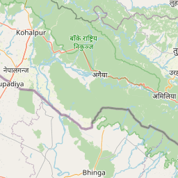
Distance Map Between Gola Gokarannath and Hardoi
Gola Gokarannath, Lucknow, India ↔ Hardoi, Lucknow, India = 52 miles = 83 km.


How far is it between Gola Gokarannāth and Hardoī
Gola Gokarannath is located in India with (28.0784,80.4705) coordinates and Hardoi is located in India with (27.3943,80.1311) coordinates. The calculated flying distance from Gola Gokarannath to Hardoi is equal to 52 miles which is equal to 83 km.
If you want to go by car, the driving distance between Gola Gokarannath and Hardoi is 100.61 km. If you ride your car with an average speed of 112 kilometers/hour (70 miles/h), travel time will be 00 hours 53 minutes. Please check the avg. speed travel time table on the right for various options.
Difference between fly and go by a car is 18 km.
| City/Place | Latitude and Longitude | GPS Coordinates |
|---|---|---|
| Gola Gokarannath | 28.0784, 80.4705 | 28° 4´ 42.1320'' N 80° 28´ 13.9440'' E |
| Hardoi | 27.3943, 80.1311 | 27° 23´ 39.5880'' N 80° 7´ 51.9600'' E |
Estimated Travel Time Between Gola Gokarannāth and Hardoī
| Average Speed | Travel Time |
|---|---|
| 30 mph (48 km/h) | 02 hours 05 minutes |
| 40 mph (64 km/h) | 01 hours 34 minutes |
| 50 mph (80 km/h) | 01 hours 15 minutes |
| 60 mph (97 km/h) | 01 hours 02 minutes |
| 70 mph (112 km/h) | 00 hours 53 minutes |
| 75 mph (120 km/h) | 00 hours 50 minutes |
Related Distances from Gola Gokarannath
| Cities | Distance |
|---|---|
| Gola Gokarannath to Shahjahanpur | 63 km |
| Gola Gokarannath to Lakhimpur | 35 km |
| Gola Gokarannath to Palia Kalan | 69 km |
| Gola Gokarannath to Sitapur | 79 km |
| Gola Gokarannath to Khutar | 27 km |
Related Distances to Hardoi
| Cities | Distance |
|---|---|
| Bilgram to Hardoi | 29 km |
| Farrukhabad to Hardoi | 71 km |
| Bangarmau to Hardoi | 65 km |
| Chhibramau to Hardoi | 106 km |
| Atrauli to Hardoi | 259 km |