Distance from Gola Gokarannath to Meerut
Distance between Gola Gokarannath and Meerut is 287 kilometers (178 miles).
Driving distance from Gola Gokarannath to Meerut is 345 kilometers (215 miles).
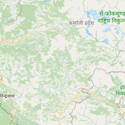
Distance Map Between Gola Gokarannath and Meerut
Gola Gokarannath, Lucknow, India ↔ Meerut, Lucknow, India = 178 miles = 287 km.


How far is it between Gola Gokarannāth and Meerut
Gola Gokarannath is located in India with (28.0784,80.4705) coordinates and Meerut is located in India with (28.9716,77.7193) coordinates. The calculated flying distance from Gola Gokarannath to Meerut is equal to 178 miles which is equal to 287 km.
If you want to go by car, the driving distance between Gola Gokarannath and Meerut is 345.42 km. If you ride your car with an average speed of 112 kilometers/hour (70 miles/h), travel time will be 03 hours 05 minutes. Please check the avg. speed travel time table on the right for various options.
Difference between fly and go by a car is 58 km.
| City/Place | Latitude and Longitude | GPS Coordinates |
|---|---|---|
| Gola Gokarannath | 28.0784, 80.4705 | 28° 4´ 42.1320'' N 80° 28´ 13.9440'' E |
| Meerut | 28.9716, 77.7193 | 28° 58´ 17.5800'' N 77° 43´ 9.6240'' E |
Estimated Travel Time Between Gola Gokarannāth and Meerut
| Average Speed | Travel Time |
|---|---|
| 30 mph (48 km/h) | 07 hours 11 minutes |
| 40 mph (64 km/h) | 05 hours 23 minutes |
| 50 mph (80 km/h) | 04 hours 19 minutes |
| 60 mph (97 km/h) | 03 hours 33 minutes |
| 70 mph (112 km/h) | 03 hours 05 minutes |
| 75 mph (120 km/h) | 02 hours 52 minutes |
Related Distances from Gola Gokarannath
| Cities | Distance |
|---|---|
| Gola Gokarannath to Shahjahanpur | 63 km |
| Gola Gokarannath to Lakhimpur | 35 km |
| Gola Gokarannath to Palia Kalan | 69 km |
| Gola Gokarannath to Sitapur | 79 km |
| Gola Gokarannath to Khutar | 27 km |
Related Distances to Meerut
| Cities | Distance |
|---|---|
| Bijnor to Meerut | 75 km |
| Mawana to Meerut | 27 km |
| Khatauli to Meerut | 36 km |
| Gajraula to Meerut | 66 km |
| Budhana to Meerut | 48 km |