Distance from Goulburn to Katoomba
Distance between Goulburn and Katoomba is 127 kilometers (79 miles).
Driving distance from Goulburn to Katoomba is 239 kilometers (149 miles).
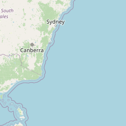
Distance Map Between Goulburn and Katoomba
Goulburn, Sydney, Australia ↔ Katoomba, Sydney, Australia = 79 miles = 127 km.


How far is it between Goulburn and Katoomba
Goulburn is located in Australia with (-34.7516,149.7209) coordinates and Katoomba is located in Australia with (-33.7198,150.3074) coordinates. The calculated flying distance from Goulburn to Katoomba is equal to 79 miles which is equal to 127 km.
If you want to go by car, the driving distance between Goulburn and Katoomba is 239.11 km. If you ride your car with an average speed of 112 kilometers/hour (70 miles/h), travel time will be 02 hours 08 minutes. Please check the avg. speed travel time table on the right for various options.
Difference between fly and go by a car is 112 km.
| City/Place | Latitude and Longitude | GPS Coordinates |
|---|---|---|
| Goulburn | -34.7516, 149.7209 | 34° 45´ 5.5800'' S 149° 43´ 15.0960'' E |
| Katoomba | -33.7198, 150.3074 | 33° 43´ 11.1720'' S 150° 18´ 26.6040'' E |
Estimated Travel Time Between Goulburn and Katoomba
| Average Speed | Travel Time |
|---|---|
| 30 mph (48 km/h) | 04 hours 58 minutes |
| 40 mph (64 km/h) | 03 hours 44 minutes |
| 50 mph (80 km/h) | 02 hours 59 minutes |
| 60 mph (97 km/h) | 02 hours 27 minutes |
| 70 mph (112 km/h) | 02 hours 08 minutes |
| 75 mph (120 km/h) | 01 hours 59 minutes |
Related Distances from Goulburn
| Cities | Distance |
|---|---|
| Goulburn to Orange 2 | 202 km |
| Goulburn to Nowra | 126 km |
| Goulburn to Wagga Wagga | 263 km |
| Goulburn to Griffith 2 | 377 km |
| Goulburn to Port Macquarie | 570 km |
Related Distances to Katoomba
| Cities | Distance |
|---|---|
| Bathurst to Katoomba | 99 km |
| Wollongong to Katoomba | 161 km |
| Goulburn to Katoomba | 239 km |
| Dubbo to Katoomba | 290 km |
| Griffith 2 to Katoomba | 517 km |