Distance from Goyerkata to Jhargram
Distance between Goyerkata and Jhargram is 515 kilometers (320 miles).
Driving distance from Goyerkata to Jhargram is 706 kilometers (439 miles).
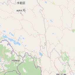
Distance Map Between Goyerkata and Jhargram
Goyerkata, Kolkata, India ↔ Jhargram, Kolkata, India = 320 miles = 515 km.


How far is it between Goyerkāta and Jhārgrām
Goyerkata is located in India with (26.6998,89.0257) coordinates and Jhargram is located in India with (22.4538,86.995) coordinates. The calculated flying distance from Goyerkata to Jhargram is equal to 320 miles which is equal to 515 km.
If you want to go by car, the driving distance between Goyerkata and Jhargram is 706.39 km. If you ride your car with an average speed of 112 kilometers/hour (70 miles/h), travel time will be 06 hours 18 minutes. Please check the avg. speed travel time table on the right for various options.
Difference between fly and go by a car is 191 km.
| City/Place | Latitude and Longitude | GPS Coordinates |
|---|---|---|
| Goyerkata | 26.6998, 89.0257 | 26° 41´ 59.4240'' N 89° 1´ 32.3400'' E |
| Jhargram | 22.4538, 86.995 | 22° 27´ 13.8240'' N 86° 59´ 41.8920'' E |
Estimated Travel Time Between Goyerkāta and Jhārgrām
| Average Speed | Travel Time |
|---|---|
| 30 mph (48 km/h) | 14 hours 42 minutes |
| 40 mph (64 km/h) | 11 hours 02 minutes |
| 50 mph (80 km/h) | 08 hours 49 minutes |
| 60 mph (97 km/h) | 07 hours 16 minutes |
| 70 mph (112 km/h) | 06 hours 18 minutes |
| 75 mph (120 km/h) | 05 hours 53 minutes |
Related Distances from Goyerkata
| Cities | Distance |
|---|---|
| Goyerkata to Koch Bihar | 74 km |
| Goyerkata to Jalpaiguri | 51 km |
| Goyerkata to Kalyani | 587 km |
| Goyerkata to Naihati | 600 km |
| Goyerkata to Jamuria | 549 km |
Related Distances to Jhargram
| Cities | Distance |
|---|---|
| Bankura to Jhargram | 112 km |
| Durgapur to Jhargram | 156 km |
| Haldia to Jhargram | 151 km |
| Bishnupur to Jhargram | 105 km |
| Ghatal to Jhargram | 114 km |