Distance from Goyerkata to Taki
Distance between Goyerkata and Taki is 457 kilometers (284 miles).
Driving distance from Goyerkata to Taki is 653 kilometers (406 miles).
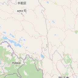
Distance Map Between Goyerkata and Taki
Goyerkata, Kolkata, India ↔ Taki, Kolkata, India = 284 miles = 457 km.


How far is it between Goyerkāta and Tāki
Goyerkata is located in India with (26.6998,89.0257) coordinates and Taki is located in India with (22.5887,88.9325) coordinates. The calculated flying distance from Goyerkata to Taki is equal to 284 miles which is equal to 457 km.
If you want to go by car, the driving distance between Goyerkata and Taki is 652.68 km. If you ride your car with an average speed of 112 kilometers/hour (70 miles/h), travel time will be 05 hours 49 minutes. Please check the avg. speed travel time table on the right for various options.
Difference between fly and go by a car is 196 km.
| City/Place | Latitude and Longitude | GPS Coordinates |
|---|---|---|
| Goyerkata | 26.6998, 89.0257 | 26° 41´ 59.4240'' N 89° 1´ 32.3400'' E |
| Taki | 22.5887, 88.9325 | 22° 35´ 19.2120'' N 88° 55´ 57.1080'' E |
Estimated Travel Time Between Goyerkāta and Tāki
| Average Speed | Travel Time |
|---|---|
| 30 mph (48 km/h) | 13 hours 35 minutes |
| 40 mph (64 km/h) | 10 hours 11 minutes |
| 50 mph (80 km/h) | 08 hours 09 minutes |
| 60 mph (97 km/h) | 06 hours 43 minutes |
| 70 mph (112 km/h) | 05 hours 49 minutes |
| 75 mph (120 km/h) | 05 hours 26 minutes |
Related Distances from Goyerkata
| Cities | Distance |
|---|---|
| Goyerkata to Guskhara | 527 km |
| Goyerkata to Habra | 604 km |
| Goyerkata to Halisahar | 612 km |
| Goyerkata to Haora | 632 km |
| Goyerkata to Hasimara | 40 km |
| Goyerkata to Ingraj Bazar | 311 km |
| Goyerkata to Islampur | 148 km |
| Goyerkata to Jalpaiguri | 51 km |
| Goyerkata to Jamuria | 549 km |
| Goyerkata to Jhalida | 656 km |
Related Distances to Taki
| Cities | Distance |
|---|---|
| Baranagar to Taki | 75 km |
| Dam Dam to Taki | 66 km |
| Durgapur to Taki | 230 km |
| Nalhati to Taki | 288 km |
| Dinhata to Taki | 753 km |
| Murshidabad to Taki | 242 km |
| Kalyani to Taki | 79 km |
| Ingraj Bazar to Taki | 364 km |
| Titagarh to Taki | 71 km |
| Ghatal to Taki | 177 km |