Distance from Grapevine to Alvin
Distance between Grapevine and Alvin is 428 kilometers (266 miles).
Driving distance from Grapevine to Alvin is 470 kilometers (292 miles).
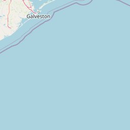
Distance Map Between Grapevine and Alvin
Grapevine, Austin, United States ↔ Alvin, Austin, United States = 266 miles = 428 km.


How far is it between Grapevine and Alvin
Grapevine is located in United States with (32.9343,-97.0781) coordinates and Alvin is located in United States with (29.4239,-95.2441) coordinates. The calculated flying distance from Grapevine to Alvin is equal to 266 miles which is equal to 428 km.
If you want to go by car, the driving distance between Grapevine and Alvin is 470.07 km. If you ride your car with an average speed of 112 kilometers/hour (70 miles/h), travel time will be 04 hours 11 minutes. Please check the avg. speed travel time table on the right for various options.
Difference between fly and go by a car is 42 km.
| City/Place | Latitude and Longitude | GPS Coordinates |
|---|---|---|
| Grapevine | 32.9343, -97.0781 | 32° 56´ 3.4440'' N 97° 4´ 41.0520'' W |
| Alvin | 29.4239, -95.2441 | 29° 25´ 25.8600'' N 95° 14´ 38.7600'' W |
Estimated Travel Time Between Grapevine and Alvin
| Average Speed | Travel Time |
|---|---|
| 30 mph (48 km/h) | 09 hours 47 minutes |
| 40 mph (64 km/h) | 07 hours 20 minutes |
| 50 mph (80 km/h) | 05 hours 52 minutes |
| 60 mph (97 km/h) | 04 hours 50 minutes |
| 70 mph (112 km/h) | 04 hours 11 minutes |
| 75 mph (120 km/h) | 03 hours 55 minutes |
Related Distances from Grapevine
| Cities | Distance |
|---|---|
| Grapevine to Dallas | 34 km |
| Grapevine to Arlington | 28 km |
| Grapevine to Frisco | 42 km |
| Grapevine to Denton | 43 km |
| Grapevine to Fort Worth | 39 km |
Related Distances to Alvin
| Cities | Distance |
|---|---|
| Galveston to Alvin | 53 km |
| Houston to Alvin | 51 km |
| Dallas to Alvin | 436 km |
| Pearland to Alvin | 17 km |
| Texas City to Alvin | 38 km |