Distance from Grays to Southampton
Distance between Grays and Southampton is 136 kilometers (85 miles).
Driving distance from Grays to Southampton is 179 kilometers (111 miles).
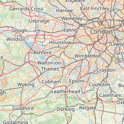
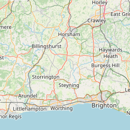
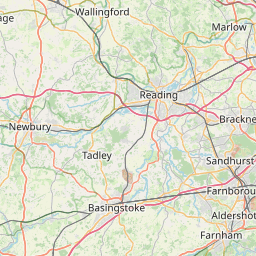
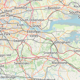
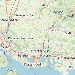
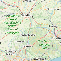
Distance Map Between Grays and Southampton
Grays, London, United Kingdom ↔ Southampton, London, United Kingdom = 85 miles = 136 km.


How far is it between Grays and Southampton
Grays is located in United Kingdom with (51.4757,0.3252) coordinates and Southampton is located in United Kingdom with (50.904,-1.4043) coordinates. The calculated flying distance from Grays to Southampton is equal to 85 miles which is equal to 136 km.
If you want to go by car, the driving distance between Grays and Southampton is 178.89 km. If you ride your car with an average speed of 112 kilometers/hour (70 miles/h), travel time will be 01 hours 35 minutes. Please check the avg. speed travel time table on the right for various options.
Difference between fly and go by a car is 43 km.
| City/Place | Latitude and Longitude | GPS Coordinates |
|---|---|---|
| Grays | 51.4757, 0.3252 | 51° 28´ 32.3760'' N 0° 19´ 30.7560'' E |
| Southampton | 50.904, -1.4043 | 50° 54´ 14.2200'' N 1° 24´ 15.4080'' W |
Estimated Travel Time Between Grays and Southampton
| Average Speed | Travel Time |
|---|---|
| 30 mph (48 km/h) | 03 hours 43 minutes |
| 40 mph (64 km/h) | 02 hours 47 minutes |
| 50 mph (80 km/h) | 02 hours 14 minutes |
| 60 mph (97 km/h) | 01 hours 50 minutes |
| 70 mph (112 km/h) | 01 hours 35 minutes |
| 75 mph (120 km/h) | 01 hours 29 minutes |
Related Distances from Grays
| Cities | Distance |
|---|---|
| Grays to City Of London | 35 km |
| Grays to Halifax 2 | 347 km |
| Grays to Harlow | 45 km |
| Grays to Harrogate | 348 km |
| Grays to Hartlepool | 428 km |
| Grays to Hastings | 96 km |
| Grays to Hemel Hempstead | 81 km |
| Grays to High Wycombe | 116 km |
| Grays to Huddersfield | 352 km |
| Grays to Hull | 320 km |
Related Distances to Southampton
| Cities | Distance |
|---|---|
| Jarrow to Southampton | 528 km |
| Brixton to Southampton | 126 km |
| Sevenoaks to Southampton | 153 km |
| Brierley Hill to Southampton | 232 km |
| Eastwood to Southampton | 289 km |
| Isleworth to Southampton | 111 km |
| Brownhills to Southampton | 247 km |
| Bloxwich to Southampton | 246 km |
| Slough to Southampton | 102 km |
| Telford to Southampton | 277 km |