Distance from Green to Dayton
Distance between Green and Dayton is 265 kilometers (164 miles).
Driving distance from Green to Dayton is 323 kilometers (201 miles).
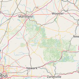
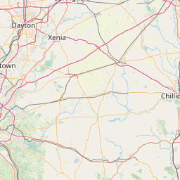
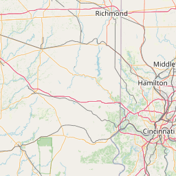
Distance Map Between Green and Dayton
Green, Columbus, United States ↔ Dayton, Columbus, United States = 164 miles = 265 km.


How far is it between Green and Dayton
Green is located in United States with (40.9459,-81.4832) coordinates and Dayton is located in United States with (39.759,-84.1916) coordinates. The calculated flying distance from Green to Dayton is equal to 164 miles which is equal to 265 km.
If you want to go by car, the driving distance between Green and Dayton is 322.8 km. If you ride your car with an average speed of 112 kilometers/hour (70 miles/h), travel time will be 02 hours 52 minutes. Please check the avg. speed travel time table on the right for various options.
Difference between fly and go by a car is 58 km.
| City/Place | Latitude and Longitude | GPS Coordinates |
|---|---|---|
| Green | 40.9459, -81.4832 | 40° 56´ 45.2040'' N 81° 28´ 59.4120'' W |
| Dayton | 39.759, -84.1916 | 39° 45´ 32.2200'' N 84° 11´ 29.7960'' W |
Estimated Travel Time Between Green and Dayton
| Average Speed | Travel Time |
|---|---|
| 30 mph (48 km/h) | 06 hours 43 minutes |
| 40 mph (64 km/h) | 05 hours 02 minutes |
| 50 mph (80 km/h) | 04 hours 02 minutes |
| 60 mph (97 km/h) | 03 hours 19 minutes |
| 70 mph (112 km/h) | 02 hours 52 minutes |
| 75 mph (120 km/h) | 02 hours 41 minutes |
Related Distances from Green
| Cities | Distance |
|---|---|
| Green to Canton 2 | 24 km |
| Green to Cuyahoga Falls | 25 km |
| Green to Akron | 20 km |
| Green to Cleveland Heights | 77 km |
| Green to Brunswick | 61 km |
Related Distances to Dayton
| Cities | Distance |
|---|---|
| Miami to Daytona Beach | 418 km |
| Fort Lauderdale to Daytona Beach | 388 km |
| Panama City to Daytona Beach | 577 km |
| Ocala to Daytona Beach | 125 km |
| Melbourne 2 to Daytona Beach | 146 km |