Distance from Gursarai to Orai
Distance between Gursarai and Orai is 50 kilometers (31 miles).
Driving distance from Gursarai to Orai is 54 kilometers (34 miles).
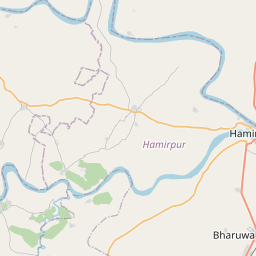
Distance Map Between Gursarai and Orai
Gursarai, Lucknow, India ↔ Orai, Lucknow, India = 31 miles = 50 km.


How far is it between Gursarāi and Orai
Gursarai is located in India with (25.6168,79.1805) coordinates and Orai is located in India with (25.9907,79.4532) coordinates. The calculated flying distance from Gursarai to Orai is equal to 31 miles which is equal to 50 km.
If you want to go by car, the driving distance between Gursarai and Orai is 53.96 km. If you ride your car with an average speed of 112 kilometers/hour (70 miles/h), travel time will be 00 hours 28 minutes. Please check the avg. speed travel time table on the right for various options.
Difference between fly and go by a car is 4 km.
| City/Place | Latitude and Longitude | GPS Coordinates |
|---|---|---|
| Gursarai | 25.6168, 79.1805 | 25° 37´ 0.3720'' N 79° 10´ 49.9080'' E |
| Orai | 25.9907, 79.4532 | 25° 59´ 26.6640'' N 79° 27´ 11.3400'' E |
Estimated Travel Time Between Gursarāi and Orai
| Average Speed | Travel Time |
|---|---|
| 30 mph (48 km/h) | 01 hours 07 minutes |
| 40 mph (64 km/h) | 00 hours 50 minutes |
| 50 mph (80 km/h) | 00 hours 40 minutes |
| 60 mph (97 km/h) | 00 hours 33 minutes |
| 70 mph (112 km/h) | 00 hours 28 minutes |
| 75 mph (120 km/h) | 00 hours 26 minutes |
Related Distances from Gursarai
| Cities | Distance |
|---|---|
| Gursarai to Orai | 54 km |
| Gursarai to Jhansi | 96 km |
| Gursarai to Rath | 116 km |
| Gursarai to Kanpur | 188 km |
| Gursarai to Mahoba | 151 km |
Related Distances to Orai
| Cities | Distance |
|---|---|
| Auraiya to Orai | 64 km |
| Konch to Orai | 31 km |
| Gursarai to Orai | 54 km |
| Hamirpur to Orai | 82 km |
| Kalpi to Orai | 33 km |