Distance from Hanoi to Kon Tum
Distance between Hanoi and Kon Tum is 776 kilometers (482 miles).
Driving distance from Hanoi to Kon Tum is 1162 kilometers (722 miles).
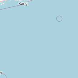
Distance Map Between Hanoi and Kon Tum
Hanoi, Vietnam ↔ Kon Tum, Vietnam = 482 miles = 776 km.


How far is it between Hanoi and Kon Tum
Hanoi is located in Vietnam with (21.0245,105.8412) coordinates and Kon Tum is located in Vietnam with (14.3545,108.0076) coordinates. The calculated flying distance from Hanoi to Kon Tum is equal to 482 miles which is equal to 776 km.
If you want to go by car, the driving distance between Hanoi and Kon Tum is 1162.4 km. If you ride your car with an average speed of 112 kilometers/hour (70 miles/h), travel time will be 10 hours 22 minutes. Please check the avg. speed travel time table on the right for various options.
Difference between fly and go by a car is 386 km.
| City/Place | Latitude and Longitude | GPS Coordinates |
|---|---|---|
| Hanoi | 21.0245, 105.8412 | 21° 1´ 28.2000'' N 105° 50´ 28.2120'' E |
| Kon Tum | 14.3545, 108.0076 | 14° 21´ 16.2360'' N 108° 0´ 27.3240'' E |
Estimated Travel Time Between Hanoi and Kon Tum
| Average Speed | Travel Time |
|---|---|
| 30 mph (48 km/h) | 24 hours 13 minutes |
| 40 mph (64 km/h) | 18 hours 09 minutes |
| 50 mph (80 km/h) | 14 hours 31 minutes |
| 60 mph (97 km/h) | 11 hours 59 minutes |
| 70 mph (112 km/h) | 10 hours 22 minutes |
| 75 mph (120 km/h) | 09 hours 41 minutes |
Related Distances from Hanoi
| Cities | Distance |
|---|---|
| Hanoi to Ho Chi Minh City | 1757 km |
| Hanoi to Hue | 722 km |
| Hanoi to Hoi An | 901 km |
| Hanoi to Sa Pa | 316 km |
| Hanoi to Vinh | 297 km |
Related Distances to Kon Tum
| Cities | Distance |
|---|---|
| Hanoi to Kon Tum | 1162 km |
| Hue to Kon Tum | 394 km |
| Da Nang to Kon Tum | 309 km |
| Buon Ma Thuot to Kon Tum | 260 km |
| Hoi An to Kon Tum | 282 km |