Distance from Hardoi to Tanda
Distance between Hardoi and Tanda is 267 kilometers (166 miles).
Driving distance from Hardoi to Tanda is 303 kilometers (188 miles).
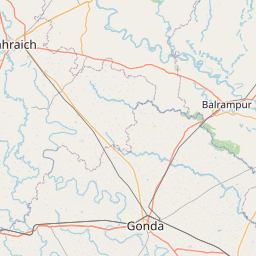
Distance Map Between Hardoi and Tanda
Hardoi, Lucknow, India ↔ Tanda, Lucknow, India = 166 miles = 267 km.


How far is it between Hardoī and Tāndā
Hardoi is located in India with (27.3943,80.1311) coordinates and Tanda is located in India with (26.5506,82.658) coordinates. The calculated flying distance from Hardoi to Tanda is equal to 166 miles which is equal to 267 km.
If you want to go by car, the driving distance between Hardoi and Tanda is 303.05 km. If you ride your car with an average speed of 112 kilometers/hour (70 miles/h), travel time will be 02 hours 42 minutes. Please check the avg. speed travel time table on the right for various options.
Difference between fly and go by a car is 36 km.
| City/Place | Latitude and Longitude | GPS Coordinates |
|---|---|---|
| Hardoi | 27.3943, 80.1311 | 27° 23´ 39.5880'' N 80° 7´ 51.9600'' E |
| Tanda | 26.5506, 82.658 | 26° 33´ 2.2680'' N 82° 39´ 28.8720'' E |
Estimated Travel Time Between Hardoī and Tāndā
| Average Speed | Travel Time |
|---|---|
| 30 mph (48 km/h) | 06 hours 18 minutes |
| 40 mph (64 km/h) | 04 hours 44 minutes |
| 50 mph (80 km/h) | 03 hours 47 minutes |
| 60 mph (97 km/h) | 03 hours 07 minutes |
| 70 mph (112 km/h) | 02 hours 42 minutes |
| 75 mph (120 km/h) | 02 hours 31 minutes |
Related Distances from Hardoi
| Cities | Distance |
|---|---|
| Hardoi to Sandila | 57 km |
| Hardoi to Shahabad | 36 km |
| Hardoi to Sitapur | 65 km |
| Hardoi to Pihani | 28 km |
| Hardoi to Sandi | 22 km |
Related Distances to Tanda
| Cities | Distance |
|---|---|
| Akbarpur to Tanda 2 | 19 km |
| Basti to Tanda 2 | 38 km |
| Sultanpur to Tanda 2 | 74 km |
| Ayodhya to Tanda 2 | 59 km |
| Gorakhpur 2 to Tanda 2 | 108 km |