Distance from Heihe to Lingdong
Distance between Heihe and Lingdong is 490 kilometers (304 miles).
Driving distance from Heihe to Lingdong is 776 kilometers (482 miles).
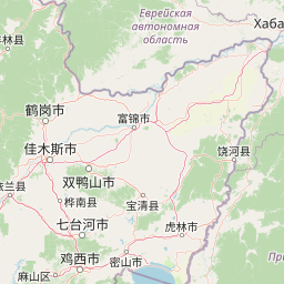
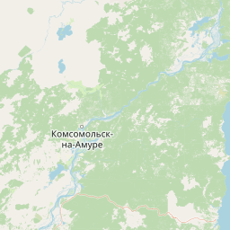
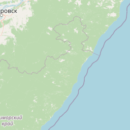
Distance Map Between Heihe and Lingdong
Heihe, Harbin, China ↔ Lingdong, Harbin, China = 304 miles = 490 km.


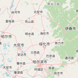


How far is it between Heihe and Lingdong
Heihe is located in China with (50.2441,127.4902) coordinates and Lingdong is located in China with (46.5669,131.1453) coordinates. The calculated flying distance from Heihe to Lingdong is equal to 304 miles which is equal to 490 km.
If you want to go by car, the driving distance between Heihe and Lingdong is 775.52 km. If you ride your car with an average speed of 112 kilometers/hour (70 miles/h), travel time will be 06 hours 55 minutes. Please check the avg. speed travel time table on the right for various options.
Difference between fly and go by a car is 286 km.
| City/Place | Latitude and Longitude | GPS Coordinates |
|---|---|---|
| Heihe | 50.2441, 127.4902 | 50° 14´ 38.8680'' N 127° 29´ 24.5760'' E |
| Lingdong | 46.5669, 131.1453 | 46° 34´ 0.9840'' N 131° 8´ 43.0080'' E |
Estimated Travel Time Between Heihe and Lingdong
| Average Speed | Travel Time |
|---|---|
| 30 mph (48 km/h) | 16 hours 09 minutes |
| 40 mph (64 km/h) | 12 hours 07 minutes |
| 50 mph (80 km/h) | 09 hours 41 minutes |
| 60 mph (97 km/h) | 07 hours 59 minutes |
| 70 mph (112 km/h) | 06 hours 55 minutes |
| 75 mph (120 km/h) | 06 hours 27 minutes |
Related Distances from Heihe
| Cities | Distance |
|---|---|
| Heihe to Suihua | 468 km |
| Heihe to Zhaoyuan | 712 km |
| Heihe to Qiqihar | 474 km |
| Heihe to Jixi | 1021 km |
| Heihe to Suifenhe | 1058 km |
Related Distances to Lingdong
| Cities | Distance |
|---|---|
| Hailin to Lingdong | 461 km |
| Honggang to Lingdong | 629 km |
| Dongxing to Lingdong | 288 km |
| Bayan to Lingdong | 402 km |
| Fuli to Lingdong | 20 km |