Distance from Heihe to Tahe
Distance between Heihe and Tahe is 301 kilometers (187 miles).
Driving distance from Heihe to Tahe is 438 kilometers (272 miles).
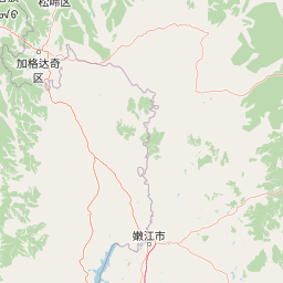
Distance Map Between Heihe and Tahe
Heihe, Harbin, China ↔ Tahe, Harbin, China = 187 miles = 301 km.


How far is it between Heihe and Tahe
Heihe is located in China with (50.2441,127.4902) coordinates and Tahe is located in China with (52.3333,124.7333) coordinates. The calculated flying distance from Heihe to Tahe is equal to 187 miles which is equal to 301 km.
If you want to go by car, the driving distance between Heihe and Tahe is 437.58 km. If you ride your car with an average speed of 112 kilometers/hour (70 miles/h), travel time will be 03 hours 54 minutes. Please check the avg. speed travel time table on the right for various options.
Difference between fly and go by a car is 137 km.
| City/Place | Latitude and Longitude | GPS Coordinates |
|---|---|---|
| Heihe | 50.2441, 127.4902 | 50° 14´ 38.8680'' N 127° 29´ 24.5760'' E |
| Tahe | 52.3333, 124.7333 | 52° 19´ 59.9880'' N 124° 43´ 59.9880'' E |
Estimated Travel Time Between Heihe and Tahe
| Average Speed | Travel Time |
|---|---|
| 30 mph (48 km/h) | 09 hours 06 minutes |
| 40 mph (64 km/h) | 06 hours 50 minutes |
| 50 mph (80 km/h) | 05 hours 28 minutes |
| 60 mph (97 km/h) | 04 hours 30 minutes |
| 70 mph (112 km/h) | 03 hours 54 minutes |
| 75 mph (120 km/h) | 03 hours 38 minutes |
Related Distances from Heihe
| Cities | Distance |
|---|---|
| Heihe to Suihua | 468 km |
| Heihe to Zhaoyuan | 712 km |
| Heihe to Qiqihar | 474 km |
| Heihe to Jixi | 1021 km |
| Heihe to Suifenhe | 1058 km |
Related Distances to Tahe
| Cities | Distance |
|---|---|
| Huanan to Tahe | 1395 km |
| Fujin to Tahe | 1485 km |
| Shangzhi to Tahe | 1128 km |
| Boli to Tahe | 1341 km |
| Taihe to Tahe | 1363 km |