Distance from Herford to Solingen
Distance between Herford and Solingen is 152 kilometers (94 miles).
Driving distance from Herford to Solingen is 172 kilometers (107 miles).
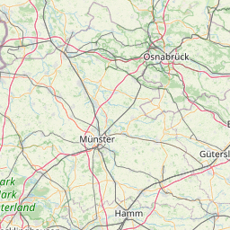
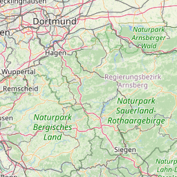
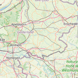
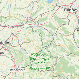
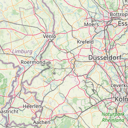
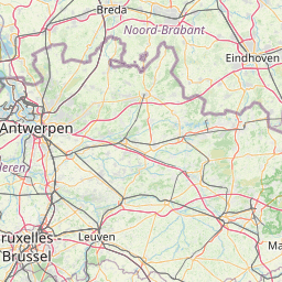
Distance Map Between Herford and Solingen
Herford, Dusseldorf, Germany ↔ Solingen, Dusseldorf, Germany = 94 miles = 152 km.


How far is it between Herford and Solingen
Herford is located in Germany with (52.1146,8.6734) coordinates and Solingen is located in Germany with (51.1734,7.0845) coordinates. The calculated flying distance from Herford to Solingen is equal to 94 miles which is equal to 152 km.
If you want to go by car, the driving distance between Herford and Solingen is 171.66 km. If you ride your car with an average speed of 112 kilometers/hour (70 miles/h), travel time will be 01 hours 31 minutes. Please check the avg. speed travel time table on the right for various options.
Difference between fly and go by a car is 20 km.
| City/Place | Latitude and Longitude | GPS Coordinates |
|---|---|---|
| Herford | 52.1146, 8.6734 | 52° 6´ 52.4520'' N 8° 40´ 24.3480'' E |
| Solingen | 51.1734, 7.0845 | 51° 10´ 24.3480'' N 7° 5´ 4.2000'' E |
Estimated Travel Time Between Herford and Solingen
| Average Speed | Travel Time |
|---|---|
| 30 mph (48 km/h) | 03 hours 34 minutes |
| 40 mph (64 km/h) | 02 hours 40 minutes |
| 50 mph (80 km/h) | 02 hours 08 minutes |
| 60 mph (97 km/h) | 01 hours 46 minutes |
| 70 mph (112 km/h) | 01 hours 31 minutes |
| 75 mph (120 km/h) | 01 hours 25 minutes |
Related Distances from Herford
| Cities | Distance |
|---|---|
| Herford to Herne | 136 km |
| Herford to Herten | 142 km |
| Herford to Herzogenrath | 270 km |
| Herford to Hiddenhausen | 10 km |
| Herford to Hilden | 178 km |
| Herford to Hille | 31 km |
| Herford to Hochfeld | 180 km |
| Herford to Hoexter | 74 km |
| Herford to Hovelhof | 44 km |
| Herford to Huckelhoven | 236 km |
Related Distances to Solingen
| Cities | Distance |
|---|---|
| Haltern to Solingen | 81 km |
| Ennigerloh to Solingen | 116 km |
| Gladbeck to Solingen | 70 km |
| Ratingen to Solingen | 31 km |
| Bonn to Solingen | 64 km |
| Duisburg to Solingen | 46 km |
| Bochum Hordel to Solingen | 54 km |
| Langenfeld to Solingen | 16 km |
| Kreuztal to Solingen | 109 km |
| Kerpen to Solingen | 59 km |