Distance from Hlukhiv to Moscow
Distance between Hlukhiv and Moscow is 514 kilometers (319 miles).
Driving distance from Hlukhiv to Moscow is 559 kilometers (347 miles).
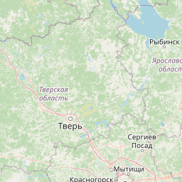
Distance Map Between Hlukhiv and Moscow
Hlukhiv, Sumy, Ukraine ↔ Moscow, Russia = 319 miles = 514 km.


How far is it between Hlukhiv and Moscow
Hlukhiv is located in Ukraine with (51.6782,33.9162) coordinates and Moscow is located in Russia with (55.7522,37.6156) coordinates. The calculated flying distance from Hlukhiv to Moscow is equal to 319 miles which is equal to 514 km.
If you want to go by car, the driving distance between Hlukhiv and Moscow is 559.17 km. If you ride your car with an average speed of 112 kilometers/hour (70 miles/h), travel time will be 04 hours 59 minutes. Please check the avg. speed travel time table on the right for various options.
Difference between fly and go by a car is 45 km.
| City/Place | Latitude and Longitude | GPS Coordinates |
|---|---|---|
| Hlukhiv | 51.6782, 33.9162 | 51° 40´ 41.5920'' N 33° 54´ 58.3200'' E |
| Moscow | 55.7522, 37.6156 | 55° 45´ 7.9920'' N 37° 36´ 56.0160'' E |
Estimated Travel Time Between Hlukhiv and Moscow
| Average Speed | Travel Time |
|---|---|
| 30 mph (48 km/h) | 11 hours 38 minutes |
| 40 mph (64 km/h) | 08 hours 44 minutes |
| 50 mph (80 km/h) | 06 hours 59 minutes |
| 60 mph (97 km/h) | 05 hours 45 minutes |
| 70 mph (112 km/h) | 04 hours 59 minutes |
| 75 mph (120 km/h) | 04 hours 39 minutes |
Related Distances from Hlukhiv
| Cities | Distance |
|---|---|
| Hlukhiv to Moscow | 559 km |
| Hlukhiv to Samara | 1345 km |
| Hlukhiv to Saint Petersburg | 1211 km |
Related Distances to Moscow
| Cities | Distance |
|---|---|
| Kiev to Moscow | 851 km |
| Kharkiv to Moscow | 744 km |
| Odessa to Moscow | 1323 km |
| Donetsk to Moscow | 1024 km |
| Sumy to Moscow | 678 km |