Distance from Houston to La Paz
Distance between Houston and La Paz is 1606 kilometers (998 miles).
Driving distance from Houston to La Paz is 2273 kilometers (1412 miles).
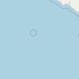
Distance Map Between Houston and La Paz
Houston, Austin, United States ↔ La Paz, Mexico = 998 miles = 1606 km.


How far is it between Houston and La Paz
Houston is located in United States with (29.7633,-95.3633) coordinates and La Paz is located in Mexico with (24.1381,-110.3097) coordinates. The calculated flying distance from Houston to La Paz is equal to 998 miles which is equal to 1606 km.
If you want to go by car, the driving distance between Houston and La Paz is 2273 km. If you ride your car with an average speed of 112 kilometers/hour (70 miles/h), travel time will be 20 hours 17 minutes. Please check the avg. speed travel time table on the right for various options.
Difference between fly and go by a car is 667 km.
| City/Place | Latitude and Longitude | GPS Coordinates |
|---|---|---|
| Houston | 29.7633, -95.3633 | 29° 45´ 47.8080'' N 95° 21´ 47.7720'' W |
| La Paz | 24.1381, -110.3097 | 24° 8´ 17.1960'' N 110° 18´ 35.0280'' W |
Estimated Travel Time Between Houston and La Paz
| Average Speed | Travel Time |
|---|---|
| 30 mph (48 km/h) | 47 hours 21 minutes |
| 40 mph (64 km/h) | 35 hours 30 minutes |
| 50 mph (80 km/h) | 28 hours 24 minutes |
| 60 mph (97 km/h) | 23 hours 25 minutes |
| 70 mph (112 km/h) | 20 hours 17 minutes |
| 75 mph (120 km/h) | 18 hours 56 minutes |
Related Distances from Houston
| Cities | Distance |
|---|---|
| Houston to Mexico City | 1693 km |
| Houston to Cancun | 2865 km |
| Houston to Monterrey | 793 km |
| Houston to Chihuahua | 1294 km |
| Houston to Rio Grande 2 | 1312 km |
Related Distances to La Paz
| Cities | Distance |
|---|---|
| San Diego to La Paz 2 | 1500 km |
| Los Angeles to La Paz 2 | 1694 km |
| Las Vegas to La Paz 2 | 2039 km |
| Tucson to La Paz 2 | 1136 km |
| San Francisco to La Paz 2 | 2308 km |